Normal view

Received before yesterday

NASA Flight Tests Wildland Fire Tech Ahead of Demo

31 January 2025 at 12:26

4 min read

Preparations for Next Moonwalk Simulations Underway (and Underwater)

An FVR90 unmanned aerial vehicle (UAV) lifts off from the Monterey Bay Academy Airport near Watsonville, California, during the Advanced Capabilities for Emergency Response Operations (ACERO) Shakedown Test in November 2024.
NASA/Don Richey

NASA is collaborating with the wildland fire community to provide tools for some of the most challenging aspects of firefighting – particularly aerial nighttime operations.  

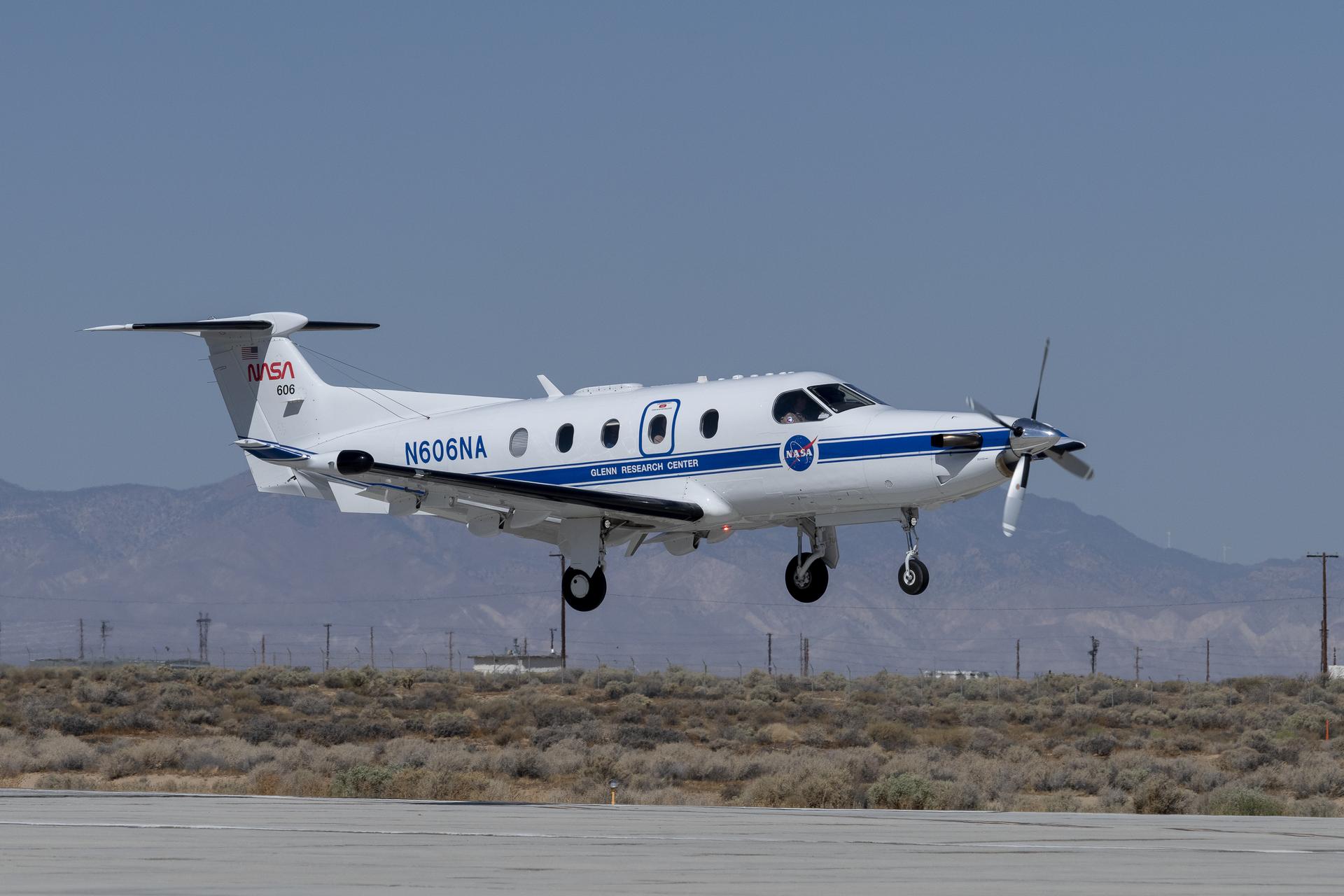
In the future, agencies could more efficiently use drones, both remotely piloted and fully autonomous, to help fight wildfires. NASA recently tested technologies with teams across the country that will enable aircraft – including small drones and helicopters outfitted with autonomous technology for remote piloting – to monitor and fight wildfires 24 hours a day, even during low-visibility conditions. 

Current aerial firefighting operations are limited to times when aircraft have clear visibility – otherwise, pilots run the risk of flying into terrain or colliding with other aircraft. NASA-developed airspace management technology will enable drones and remotely piloted aircraft to operate at night, expanding the window of time responders have to aerially suppress fires.

“We’re aiming to provide new tools – including airspace management technologies – for 24-hour drone operations for wildfire response,” said Min Xue, project manager of the Advanced Capabilities for Emergency Response Operations (ACERO) project within NASA’s Aeronautics Research Mission Directorate. “This testing will provide valuable data to inform how we mature this technology for eventual use in the field.” 

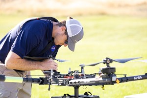
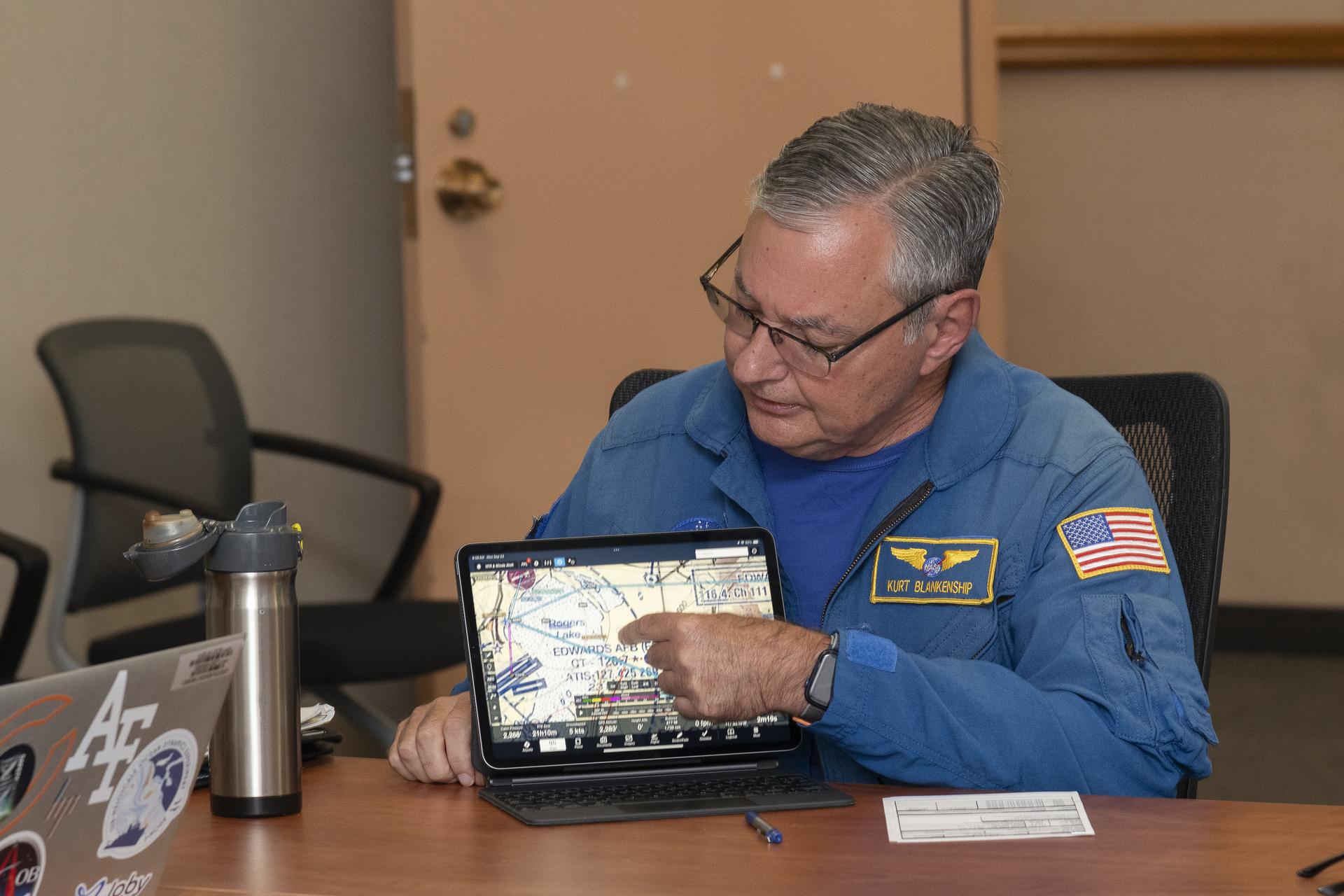
Over the past year, ACERO researchers developed a portable airspace management system (PAMS) drone pilots can use to safely send aircraft into wildfire response operations when operating drones from remote control systems or ground control stations.  

Each PAMS, roughly the size of a carry-on suitcase, is outfitted with a computer for airspace management, a radio for sharing information among PAMS units, and an Automatic Dependent Surveillance-Broadcast receiver for picking up nearby air traffic – all encased in a durable and portable container. 

NASA software on the PAMS allows drone pilots to avoid airborne collisions while remotely operating aircraft by monitoring and sharing flight plans with other aircraft in the network. The system also provides basic fire location and weather information. A drone equipped with a communication device acts as an airborne communication relay for the ground-based PAMS units, enabling them to communicate with each other without relying on the internet.  

Engineers fly a drone at NASA’s Langley Research Center in Hampton, Virginia, to test aerial coordination capabilities.
NASA/Mark Knopp

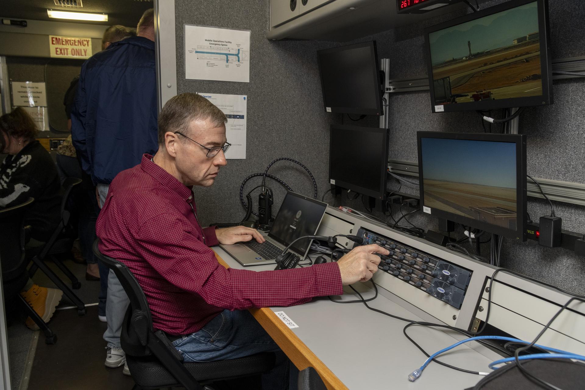
To test the PAMS units’ ability to share and display vital information, NASA researchers placed three units in different locations outside each other’s line of sight at a hangar at NASA’s Ames Research Center in California’s Silicon Valley.

Researchers stationed at each unit entered a flight plan into their system and observed that each unit successfully shared flight plans with the others through a mesh radio network. 

Next, researchers worked with team members in Virginia to test an aerial communications radio relay capability. 

Researchers outfitted a long-range vertical takeoff and landing aircraft with a camera, computer, a mesh radio, and an Automatic Dependent Surveillance-Broadcast receiver for air traffic information.

The team flew the aircraft and two smaller drones at NASA’s Langley Research Center in Hampton, Virginia, purposely operating them outside each other’s line of sight.  

The mesh radio network aboard the larger drone successfully connected with the small drones and multiple radio units on the ground. 

Yasmin Arbab front-right frame, Alexey Munishkin, Shawn Wolfe, with Sarah Mitchell, standing behind, works with the Advanced Capabilities for Emergency Response Operations (ACERO) Portable Airspace Management System (PAMS) case at the Monterey Bay Academy Airport near Watsonville, California.
NASA/Don Richey

NASA researchers then tested the PAMS units’ ability to coordinate through an aerial communications relay to simulate what it could be like in the field.  

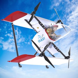
At Monterey Bay Academy Airport in Watsonville, California, engineers flew a winged drone with vertical takeoff and landing capability by Overwatch Aero, establishing a communications relay to three different PAMS units. Next, the team flew two smaller drones nearby.  

Researchers tested the PAMS units’ ability to receive communications from the Overwatch aircraft and share information with other PAMS units. Pilots purposely submitted flight plans that would conflict with each other and intentionally flew the drones outside preapproved flight plans. 

The PAMS units successfully alerted pilots to conflicting flight plans and operations outside preapproved zones. They also shared aircraft location with each other and displayed weather updates and simulated fire location data. 

The test demonstrated the potential for using PAM units in wildfire operations.  

“This testing is a significant step towards improving aerial coordination during a wildfire,” Xue said. “These technologies will improve wildfire operations, reduce the impacts of large wildfires, and save more lives,” Xue said.  

This year, the team will perform a flight evaluation to further mature these wildfire technologies. Ultimately, the project aims to transfer this technology to the firefighting community community. 

This work is led by the ACERO project under NASA’s Aeronautics Research Mission Directorate and supports the agency’s Advanced Air Mobility mission.  

Facebook logo
Instagram logo
Linkedin logo
Keep Exploring

Discover More Topics From NASA

NASA Tests Air Traffic Surveillance Technology Using Its Pilatus PC-12 Aircraft

23 January 2025 at 09:58

3 min read

Preparations for Next Moonwalk Simulations Underway (and Underwater)

NASA’s Pilatus PC-12 flies over the runway at NASA’s Armstrong Flight Research Center. The white plane shines bright against the Mojave Desert landscape. The red NASA worm figures prominently on the tail of the plane and a blue stripe lining the fuselage with the NASA meatball logo under the pilot's window. The plane’s call sign, also in blue, N606NA is brightly painted above the blue stripe.
Equipped with state-of-the-art technology to test and evaluate communication, navigation, and surveillance systems NASA’s Pilatus PC-12 performs touch-and-go maneuvers over a runway at NASA’s Armstrong Flight Research Center in Edwards, California on Sept. 23, 2024. Researchers will use the data to understand Automatic Dependent Surveillance-Broadcast (ADS-B) signal loss scenarios for air taxi flights in urban areas. To prepare for ADS-B test flights pilots and crew from NASA Armstrong and NASA’s Glenn Research Center in Cleveland, ran a series of familiarization flights. These flights included several approach and landings, with an emphasis on avionics, medium altitude air-work with steep turns, slow flight and stall demonstrations.
NASA/Steve Freeman

As air taxis, drones, and other innovative aircraft enter U.S. airspace, systems that communicate an aircraft’s location will be critical to ensure air traffic safety.

The Federal Aviation Administration (FAA) requires aircraft to communicate their locations to other aircraft and air traffic control in real time using an Automatic Dependent Surveillance-Broadcast (ADS-B) system. NASA is currently evaluating an ADS-B system’s ability to prevent collisions in a simulated urban environment. Using NASA’s Pilatus PC-12 aircraft, researchers are investigating how these systems could handle the demands of air taxis flying at low altitudes through cities.  

When operating in urban areas, one particular challenge for ADS-B systems is consistent signal coverage. Like losing cell-phone signal, air taxis flying through densely populated areas may have trouble maintaining ADS-B signals due to distance or interference. If that happens, those vehicles become less visible to air traffic control and other aircraft in the area, increasing the likelihood of collisions.

In a briefing room at NASA’s Armstrong Flight Research Center, in Edwards, California, NASA pilot Kurt Blankenship wears a blue flight-suit and sits at a brown desk to review flight plans on a rectangular flight tablet. The tablet displays a map of Edwards Air Force Base and Rogers Dry Lakebed with directional lines in light blue and flight zones designated in dashed lines and purple circles.
NASA pilot Kurt Blankenship maps out flight plans during a pre-flight brief. Pilots, crew, and researchers from NASA’s Armstrong Flight Research Center in Edwards, California and NASA’s Glenn Research Center in Cleveland are briefed on the flight plan to gather Automatic Dependent Surveillance-Broadcast signal data between the aircraft and ping-Stations on the ground at NASA Armstrong. These flights are the first cross-center research activity with the Pilatus-PC-12 at NASA Armstrong.
NASA/Steve Freeman

To simulate the conditions of an urban flight area and better understand signal loss patterns, NASA researchers established a test zone at NASA’s Armstrong Flight Research Center in Edwards, California, on Sept. 23 and 24, 2024.

Flying in the agency’s Pilatus PC-12 in a grid pattern over four ADS-B stations, researchers collected data on signal coverage from multiple ground locations and equipment configurations. Researchers were able to pinpoint where signal dropouts occurred from the strategically placed ground stations in connection to the plane’s altitude and distance from the stations. This data will inform future placement of additional ground stations to enhance signal boosting coverage.  

“Like all antennas, those used for ADS-B signal reception do not have a constant pattern,” said Brad Snelling, vehicle test team chief engineer for NASA’s Air Mobility Pathfinders project. “There are certain areas where the terrain will block ADS-B signals and depending on the type of antenna and location characteristics, there are also flight elevation angles where reception can cause signal dropouts,” Snelling said. “This would mean we need to place additional ground stations at multiple locations to boost the signal for future test flights. We can use the test results to help us configure the equipment to reduce signal loss when we conduct future air taxi flight tests.”

Wearing a dark red shirt, NASA researcher Dennis Iannicca, sits at a control monitor with three video screens, a laptop, and a control board with dials. The gray-colored control station is inside the Mobile Operations Facility, a large trailer that houses multiple computer workstations to monitor flight testing. The ADS-B research is being done at NASA’s Armstrong Flight Research Center in Edwards, California.
Working in the Mobile Operations Facility at NASA’s Armstrong Flight Research Center in Edwards, California, NASA Advanced Air Mobility researcher Dennis Iannicca adjusts a control board to capture Automatic Dependent Surveillance-Broadcast (ADS-B) data during test flights. The data will be used to understand ADS-B signal loss scenarios for air taxi flights in urban areas.
NASA/Steve Freeman

The September flights at NASA Armstrong built upon earlier tests of ADS-B in different environments. In June, researchers at NASA’s Glenn Research Center in Cleveland flew the Pilatus PC-12 and found a consistent ADS-B signal between the aircraft and communications antennas mounted on the roof of the center’s Aerospace Communications Facility. Data from these flights helped researchers plan out the recent tests at NASA Armstrong. In December 2020, test flights performed under NASA’s Advanced Air Mobility National Campaign used an OH-58C Kiowa helicopter and ground-based ADS-B stations at NASA Armstrong to collect baseline signal information.

NASA’s research in ADS-B signals and other communication, navigation, and surveillance systems will help revolutionize U.S. air transportation. Air Mobility Pathfinders researchers will evaluate the data from the three separate flight tests to understand the different signal transmission conditions and equipment needed for air taxis and drones to safely operate in the National Air Space. NASA will use the results of this research to design infrastructure to support future air taxi communication, navigation, and surveillance research and to develop new ADS-B-like concepts for uncrewed aircraft systems.

❌