Normal view

Received before yesterday

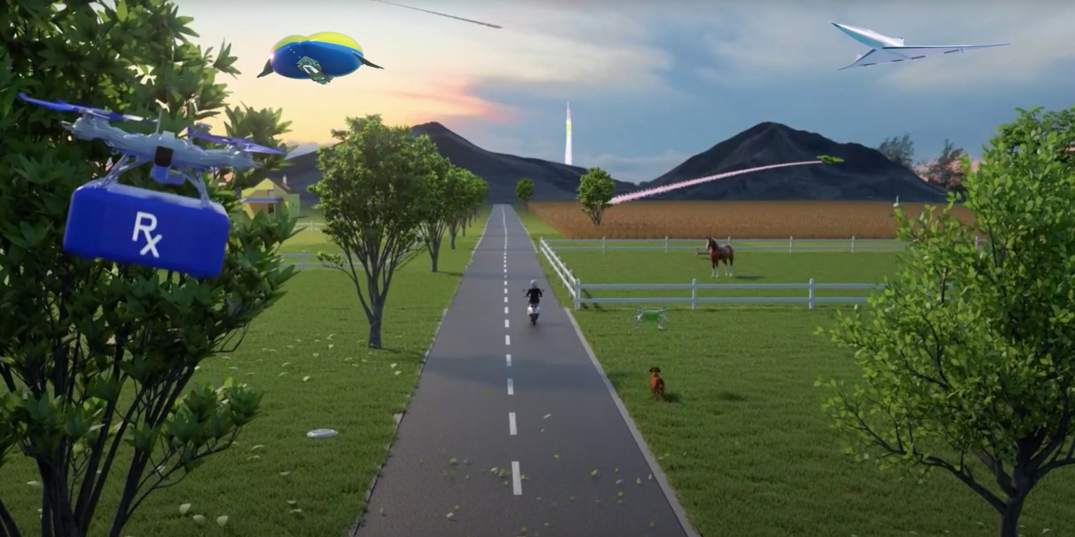
NASA Studies Wind Effects and Aircraft Tracking with Joby Aircraft

17 April 2025 at 16:00

3 min read

Preparations for Next Moonwalk Simulations Underway (and Underwater)

A yellow traffic cone and a black tripod with black testing instruments stands in the foreground on a concrete pad with a desert landscape, power lines, and a black and white aircraft in the background. The aircraft has six black propellors that sit on white arms and connect to the aircraft body, which has black doors and is pod-shaped. The aircraft sits on three small wheels.
One of several NASA distributed sensing ground nodes is set up in the foreground while an experimental air taxi aircraft owned by Joby Aviation sits in the background near NASA’s Armstrong Flight Research Center in Edwards, California, on March 12, 2025. NASA is collecting information during this study to help advance future air taxi flights, especially those occurring in cities, to track aircraft moving through traffic corridors and around landing zones.
NASA/Genaro Vavuris

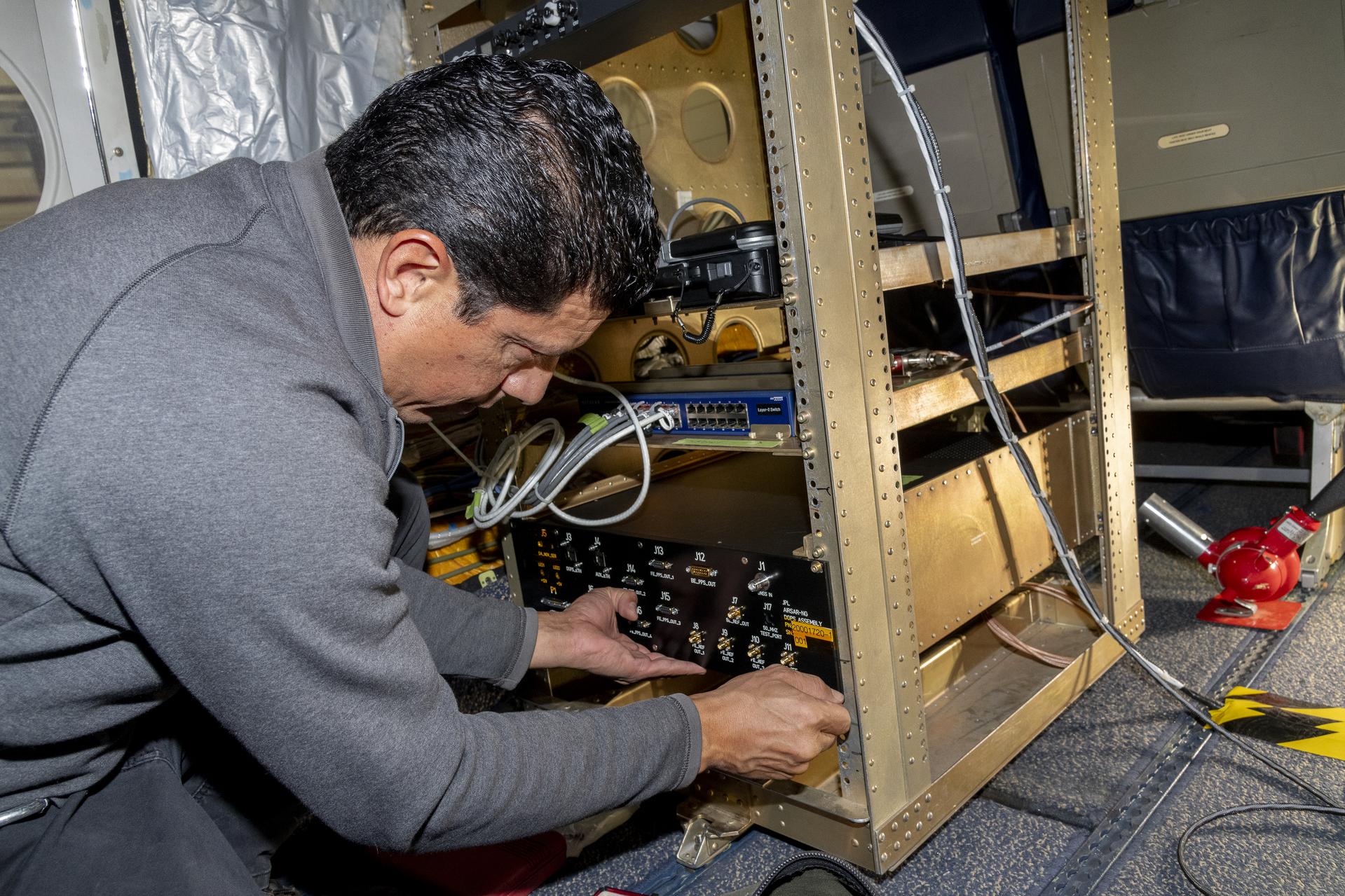
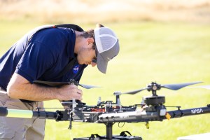
NASA engineers began using a network of ground sensors in March to collect data from an experimental air taxi to evaluate how to safely integrate such vehicles into airspace above cities – in all kinds of weather.

Researchers will use the campaign to help improve tools to assist with collision avoidance and landing operations and ensure safe and efficient air taxi operations in various weather conditions.

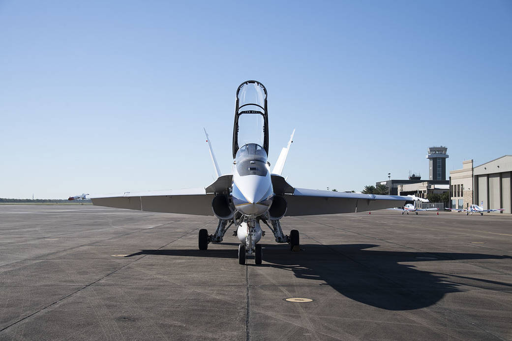
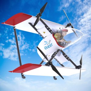
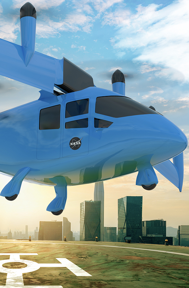
For years, NASA has looked at how wind shaped by terrain, including buildings in urban areas, can affect new types of aircraft. The latest test, which is gathering data from a Joby Aviation demonstrator aircraft, looks at another kind of wind – that which is generated by the aircraft themselves.

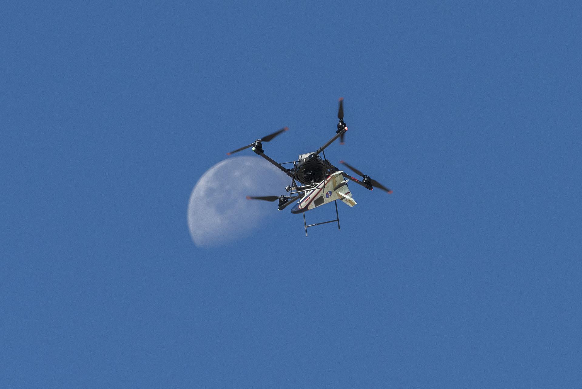
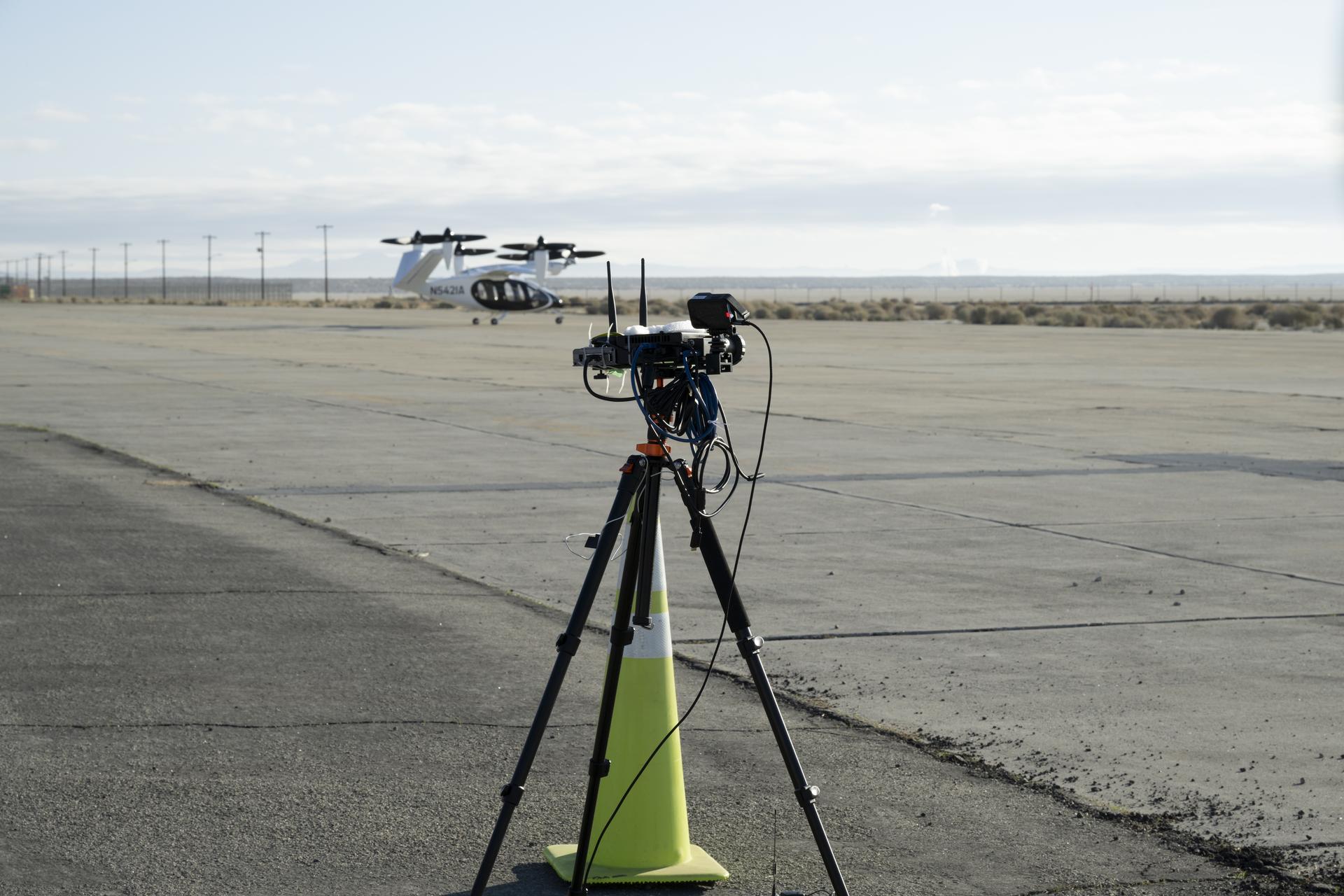
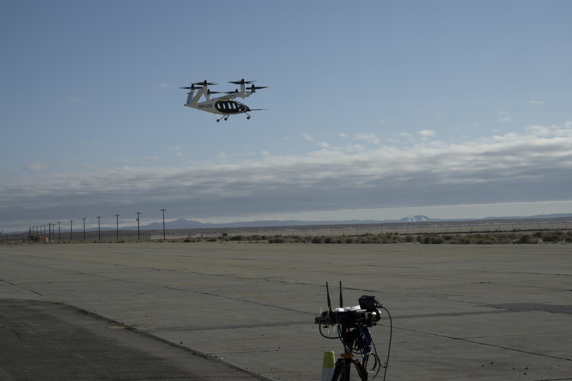
Joby flew its air taxi demonstrator over NASA’s ground sensor array near the agency’s Armstrong Flight Research Center in Edwards, California producing air flow data. The Joby aircraft has six rotors that allow for vertical takeoffs and landings, and tilt to provide lift in flight. Researchers focused on the air pushed by the propellers, which rolls into turbulent, circular patterns of wind.

Five orange traffic cones and barriers sit in front of a large white box in the foreground. In the background, a man wearing jeans and a black sweatshirt stands in front of a black laptop. Behind him, there are several cream-colored trailers, other construction equipment, and a few cars.
NASA aeronautical meteorologist Luke Bard adjusts one of several wind lidar (light detection and ranging) sensors near NASA’s Armstrong Flight Research Center in Edwards, California, on March 12, 2025, in preparation to collect data from Joby Aviation’s experimental air taxi aircraft. NASA is collecting information during this study to help advance weather-tolerant air taxi operations for the entire industry
NASA/Genaro Vavuris

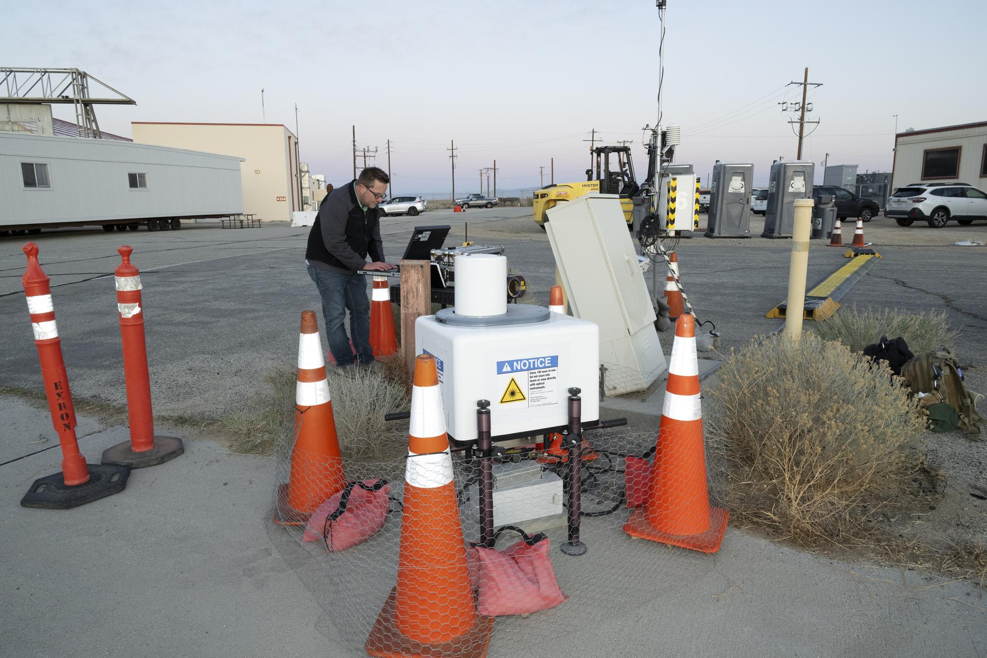
This rolling wind can affect the aircraft’s performance, especially when it’s close to the ground, as well as others flying in the vicinity and people on the ground. Such wind turbulence is difficult to measure, so NASA enhanced its sensors with a new type of lidar – a system that uses lasers to measure precise distances – and that can map out the shapes of wind features.

“The design of this new type of aircraft, paired with the NASA lidar technology during this study, warrants a better understanding of possible wind and turbulence effects that can influence safe and efficient flights,” said Grady Koch, lead for this research effort, from NASA’s Langley Research Center in Hampton, Virginia.

Data to Improve Aircraft Tracking

NASA also set up a second array of ground nodes including radar, cameras, and microphones in the same location as the sensors to provide additional data on the aircraft. These nodes will collect tracking data during routine flights for several months.

The agency will use the data gathered from these ground nodes to demonstrate the tracking capabilities and functions of its “distributed sensing” technology, which involves embedding multiple sensors in an area where aircraft are operating.

The top of a black tripod with black testing instruments stands in the foreground on a concrete pad with a desert landscape and power lines in the background. A black and white aircraft is in the sky above in the background with blue sky and clouds behind as the aircraft hovers. The aircraft has six black propellors that sit on white arms and connect to the aircraft body, which has black doors and is pod-shaped. The aircraft sits on three small wheels.
One of multiple NASA distributed sensing ground nodes is set up in the foreground while an experimental air taxi aircraft owned by Joby Aviation hovers in the background near NASA’s Armstrong Flight Research Center in Edwards, California, on March 12, 2025. NASA is collecting information during this study to help advance future air taxi flights, especially those occurring in cities, to track aircraft moving through traffic corridors and around landing zones.
NASA/Genaro Vavuris

This technology will be important for future air taxi flights, especially those occurring in cities by tracking aircraft moving through traffic corridors and around landing zones. Distributed sensing has the potential to enhance collision avoidance systems, air traffic management, ground-based landing sensors, and more.

“Our early work on a distributed network of sensors, and through this study, gives us the opportunity to test new technologies that can someday assist in airspace monitoring and collision avoidance above cities,” said George Gorospe, lead for this effort from NASA’s Ames Research Center in California’s Silicon Valley.

Using this data from an experimental air taxi aircraft, NASA will further develop the technology needed to help create safer air taxi flights in high-traffic areas. Both of these efforts will benefit the companies working to bring air taxis and drones safely into the airspace.

The work is led by NASA’s Transformational Tools and Technologies and Convergent Aeronautics Solutions projects under the Transformative Aeronautics Concepts program in support of NASA’s Advanced Air Mobility mission. NASA’s Advanced Air Mobility mission seeks to deliver data to guide the industry’s development of electric air taxis and drones.

NASA Explores Earth Science with New Navigational System

7 February 2025 at 12:00

3 min read

Preparations for Next Moonwalk Simulations Underway (and Underwater)

A white plane flies overhead against a dark blue sky. The plane is heading toward the left of the frame, and the NASA insignia is visible on its tail.
The G-IV aircraft flies overhead in the Mojave Desert near NASA’s Armstrong Flight Research Center in Edwards, California. Baseline flights like this one occurred in June 2024, and future flights in service of science research will benefit from the installment of the Soxnav navigational system, developed in collaboration with NASA’s Jet Propulsion Laboratory in Southern California and the Bay Area Environmental Research Institute in California’s Silicon Valley. This navigational system provides precise, economical aircraft guidance for a variety of aircraft types moving at high speeds.
NASA/Carla Thomas

NASA and its partners recently tested an aircraft guidance system that could help planes maintain a precise course even while flying at high speeds up to 500 mph. The instrument is Soxnav, the culmination of more than 30 years of development of aircraft navigation systems.

NASA’s G-IV aircraft flew its first mission to test this navigational system from NASA’s Armstrong Flight Research Center in Edwards, California, in December 2024. The team was composed of engineers from NASA Armstrong, NASA’s Jet Propulsion Laboratory in Southern California, and the Bay Area Environmental Research Institute (BAERI) in California’s Silicon Valley.

“The objective was to demonstrate this new system can keep a high-speed aircraft within just a few feet of its target track, and to keep it there better than 90% of the time,” said John Sonntag, BAERI independent consultant co-developer of Soxnav.

With 3D automated steering guidance, Soxnav provides pilots with a precision approach aid for landing in poor visibility. Previous generations of navigational systems laid the technical baseline for Soxnav’s modern, compact, and automated iteration.

“The G-IV is currently equipped with a standard autopilot system,” said Joe Piotrowski Jr., operations engineer for the G-IV. “But Soxnav will be able to create the exact level flight required for Next Generation Airborne Synthetic Aperture Radar (AirSAR-NG) mission success.”

A man crouches on the floor inside an aircraft while he leans over a metal instrument rack installed onboard. One hand supports the instrument panel while his other fiddles with a component of the instrument. He has a gray jacket on and short black hair.
Jose “Manny” Rodriguez adjusts the Soxnav instrument onboard the G-IV aircraft in December 2024. As part of the team of experts, Rodriguez ensures that the electronic components of this instrument are installed efficiently. His expertise will help bring the innovative navigational guidance of the Soxnav system to the G-IV and the wider airborne science fleet at NASA. Precision guidance provided by the Soxnav enables research aircraft like the G-IV to collect more accurate, more reliable Earth science data to scientists on the ground.
NASA/Steve Freeman

Guided by Soxnav, the G-IV may be able to deliver better, more abundant, and less expensive scientific information. For instance, the navigation tool optimizes observations by AirSAR-NG, an instrument that uses three radars simultaneously to observe subtle changes in the Earth’s surface. Together with the Soxnav system, these three radars provide enhanced and more accurate data about Earth science.

“With the data that can be collected from science flights equipped with the Soxnav instrument, NASA can provide the general public with better support for natural disasters, tracking of food and water supplies, as well as general Earth data about how the environment is changing,” Piotrowski said.

Ultimately, this economical flight guidance system is intended to be used by a variety of aircraft types and support a variety of present and future airborne sensors. “The Soxnav system is important for all of NASA’s Airborne Science platforms,” said Fran Becker, project manager for the G-IV AirSAR-NG project at NASA Armstrong. “The intent is for the system to be utilized by any airborne science platform and satisfy each mission’s goals for data collection.”

In conjunction with the other instruments outfitting the fleet of airborne science aircraft, Soxnav facilitates the generation of more abundant and higher quality scientific data about planet Earth. With extreme weather events becoming increasingly common, quality Earth science data can improve our understanding of our home planet to address the challenges we face today, and to prepare for future weather events.

“Soxnav enables better data collection for people who can use that information to safeguard and improve the lives of future generations,” Sonntag said.

Share

Details

Last Updated
Feb 07, 2025
Editor
Dede Dinius
Contact
Erica Heim

Wind Over Its Wing: NASA’s X-66 Model Tests Airflow

5 February 2025 at 15:00

2 min read

Preparations for Next Moonwalk Simulations Underway (and Underwater)

There is a half model of an airplane in the center of the photo that is painted white, the background of the photo is black in the center with blue lights all around the side. The floor that the half model of the plane sits on is white.
NASA’s Sustainable Flight Demonstrator project concluded wind tunnel testing in the fall of 2024. Tests on a Boeing-built X-66 model were completed at NASA’s Ames Research Center in California’s Silicon Valley in its 11-Foot Transonic Unitary Plan Facility. The model underwent tests representing expected flight conditions to obtain engineering information to influence design of the wing and provide data for flight simulators.
NASA/Brandon Torres Navarrete

NASA’s Sustainable Flight Demonstrator (SFD) project recently concluded wind tunnel tests of its X-66 semi-span model in partnership with Boeing. The model, designed to represent half the aircraft, allows the research team to generate high-quality data about the aerodynamic forces that would affect the actual X-66.

Test results will help researchers identify areas where they can refine the X-66 design – potentially reducing drag, enhancing fuel efficiency, or adjusting the vehicle shape for better flying qualities.

Tests on the Boeing-built X-66 semi-span model were completed at NASA’s Ames Research Center in California’s Silicon Valley in its 11-Foot Transonic Unitary Plan Facility. The model underwent tests representing expected flight conditions so the team could obtain engineering information to influence the design of the aircraft’s wing and provide data for flight simulators.

Photo with part of an airplane wing colored white, with markings is in the foreground, the background has white vertical lines.
NASA’s Sustainable Flight Demonstrator project concluded wind tunnel testing in the fall of 2024. Tests on a Boeing-built X-66 model were completed at NASA’s Ames Research Center in California’s Silicon Valley in its 11-Foot Transonic Unitary Plan Facility. Pressure points, which are drilled holes with data sensors attached, are installed along the edge of the wing and allow engineers to understand the characteristics of airflow and will influence the final design of the wing.
NASA/Brandon Torres Navarrete

Semi-span tests take advantage of symmetry. The forces and behaviors on a model of half an aircraft mirror those on the other half. By using a larger half of the model, engineers increase the number of surface pressure measurements. Various sensors were placed on the wing to measure forces and movements to calculate lift, drag, stability, and other important characteristics.

The semi-span tests follow earlier wind tunnel work at NASA’s Langley Research Center in Hampton, Virginia, using a smaller model of the entire aircraft. Engineers will study the data from all of the X-66 wind tunnel tests to determine any design changes that should be made before fabrication begins on the wing that will be used on the X-66 itself.

The SFD project is NASA’s effort to develop more efficient aircraft configurations as the nation moves toward aviation that’s more economically, societally, and environmentally sustainable. The project seeks to provide information to inform the next generation of single-aisle airliners, the most common aircraft in commercial aviation fleets around the world.  Boeing and NASA are partnering to develop the X-66 experimental demonstrator aircraft.

Helicopter Removes Artifact from NASA Armstrong Rooftop

9 January 2025 at 10:00

3 min read

Preparations for Next Moonwalk Simulations Underway (and Underwater)

NASA/Lori Losey

What do the X-15 and the space shuttles have in common? Information from the rocket plane and the spacecraft, as well as many experimental aircraft, were tracked from a pedestal and telemetry dish during key eras in flight history at or near NASA’s Armstrong Flight Research Center in Edwards, California.

When the NASA facility’s administration Building 4800 was built in the 1950s, the infrastructure was included to anchor the rooftop pedestal and dish as the primary way to gather data from aircraft during flights. It was retired in 2015, but a recent roofing project enabled relocation of the artifact to a new place of honor for its support of many experimental aircraft such as the lifting body aircraft, the reverse swept wing X-29, and the highly maneuverable X-31.

“Gathering telemetry data from aircraft on missions is at the core of what we do. Close proximity to the back ramp was one of the big advantages of having the telemetry antenna on the roof in the early days,” said Bob Guere, NASA Armstrong Range Operations chief, referring to the area where aircraft taxi from the hangar to the flightline. “You were able to support ground tests and check airplanes before they taxied without having to use telemetry antennas positioned further away.”

A man secures a cable to a rooftop pedestal.
A cable is secured on a rooftop pedestal located on Building 4800 at NASA’s Armstrong Flight Research Center in Edwards, California, on Oct. 4, 2024. The pedestal, which was prepared for a helicopter lift to remove it from the roof, was used since the 1950s until 2015 to enable different telemetry dishes to collect data from research aircraft.
NASA/Carla Thomas

The rooftop pedestal was key in the early days of the center and its refurbishment in 2003 restored its value. The transformation also included certification to meet Space Shuttle Program landing requirements.

“When a space shuttle deorbited from space it was coming over the top of Edwards,” Guere said. “Telemetry antennas on the hill near NASA Armstrong looked down and with dirt and concrete in the background there were reflections. The rooftop antenna was closer to ground level and looked up as the orbiter was coming in for a landing. It provided an excellent link for shuttle landings.”

The pedestal and dish were not removed when it was decommissioned because of the cost. Now, it’s economical to use a helicopter to remove the pedestal from the roof compared to other options as part of a major project focusing primarily on re-roofing Building 4800. The helicopter lift of the pedestal took a month to plan, plus time to obtain airspace operation and landing permits from the Air Force for the removal project, said Bryan Watters, NASA Armstrong roof project manager.

A helicopter is positioned to carry a rooftop pedestal.
A helicopter is positioned to remove a rooftop pedestal from Building 4800 at NASA’s Armstrong Flight Research Center in Edwards, California, on Oct. 4, 2024. The pedestal was used since the 1950s to 2015 to house different telemetry dishes to collect data from research aircraft.
NASA/Carla Thomas

The pedestal and riser measured 16 feet tall above the rooftop and housed an assembly for the 12-foot dish to rotate. The pedestal and dish together weight about 2,500 pounds and were removed separately. Crews checked the eight bolts anchoring the pedestal and dish to infrastructure on the roof prior to the arrival of a helicopter Oct. 3 before the helicopter arrived.

The following day, after additional briefings, the helicopter was positioned over Building 4800 and a cable was lowered and attached to the pedestal. Once secured, the helicopter slowly gained altitude and took its passenger to the south side of the building. There it was released from the cable and taken to a nearby warehouse for storage. Roofers demolished the steel platform on which the pedestal was located to prepare the area for new roofing materials.

Officials have not determined where the pedestal will be displayed. There are several options to place the pedestal and dish by the famous retired research aircraft on display near the entrance of NASA Armstrong.

A man helps guide a pedestal hanging from a helicopter to a safe position on the ground.
A pedestal carried by a helicopter is positioned for a gentle placement on the ground. The helicopter removed the pedestal from the rooftop of Building 4800 at NASA’s Armstrong Flight Research Center in Edwards, California, on Oct. 4, 2024. The pedestal was used since the 1950s to 2015 to house different telemetry dishes to collect data from research aircraft.
NASA/Carla Thomas
A pedestal and dish are positioned on a rooftop.
A rooftop pedestal and telemetry dish gathered information from research aircraft at Building 4800 at NASA’s Armstrong Flight Research Center in Edwards, California. The pedestal was used since the 1950s to 2015 to house different dishes to collect data from research aircraft. On Oct. 4, 2024, a helicopter was used to remove the pedestal from the roof.
NASA/Jim Ross

Share

Details

Last Updated
Jan 08, 2025
Editor
Dede Dinius
Contact

NASA Small Business Funding Enables Aircraft Inspection by Drone

13 January 2025 at 09:50

3 min read

Preparations for Next Moonwalk Simulations Underway (and Underwater)

A small, black drone with four rotors is shown in the foreground flying in front of a commercial airliner in the background. The airliner is painted white and the front facing windows can be seen behind the drone. Concrete platforms surround the commercial airliner and yellow ramps connect the platforms to the plane.
A Boeing 777-300ER aircraft is being inspected by one of Near Earth Autonomy’s drones Feb. 2, 2024, at an Emirates Airlines facility in Dubai, United Arab Emirates.
Near Earth Autonomy

A small business called Near Earth Autonomy developed a time-saving solution using drones for pre-flight checks of commercial airliners through a NASA Small Business Innovation Research (SBIR) program and a partnership with The Boeing Company.

Before commercial airliners are deemed safe to fly before each trip, a pre-flight inspection must be completed. This process can take up to four hours, and can involve workers climbing around the plane to check for any issues, which can sometimes result in safety mishaps as well as diagnosis errors.

With NASA and Boeing funding to bolster commercial readiness, Near Earth Autonomy developed a drone-enabled solution, under their business unit Proxim, that can fly around a commercial airliner and gather inspection data in less than 30 minutes. The drone can autonomously fly around an aircraft to complete the inspection by following a computer-programmed task card based on the Federal Aviation Administration’s rules for commercial aircraft inspection. The card shows the flight path the drone’s software needs to take, enabling aircraft workers with a new tool to increase safety and efficiency.

“NASA has worked with Near Earth Autonomy on autonomous inspection challenges in multiple domains,” says Danette Allen, NASA senior leader for autonomous systems. 

“We are excited to see this technology spin out to industry to increase efficiencies, safety, and accuracy of the aircraft inspection process for overall public benefit.”

The photos collected from the drone are shared and analyzed remotely, which allows experts in the airline maintenance field to support repair decisions faster from any location. New images can be compared to old images to look for cracks, popped rivets, leaks, and other common issues.

The user can ask the system to create alerts if an area needs to be inspected again or fails an inspection. Near Earth Autonomy estimates that using drones for aircraft inspection can save the airline industry an average of $10,000 per hour of lost earnings during unplanned time on the ground.

Over the last six years, Near Earth Autonomy completed several rounds of test flights with their drone system on Boeing aircraft used by American Airlines and Emirates Airlines.

NASA’s Small Business Innovation Research / Small Business Technology Transfer program, managed by the agency’s Space Technology Mission Directorate, aims to bolster American ingenuity by supporting innovative ideas put forth by small businesses to fulfill NASA and industry needs. These research needs are described in annual SBIR solicitations and target technologies that have significant potential for successful commercialization. 

Small business concerns with 500 or fewer employees, or small businesses partnering with a non-profit research institution such as a university or a research laboratory can apply to participate in the NASA SBIR/STTR program.

❌