Reading view

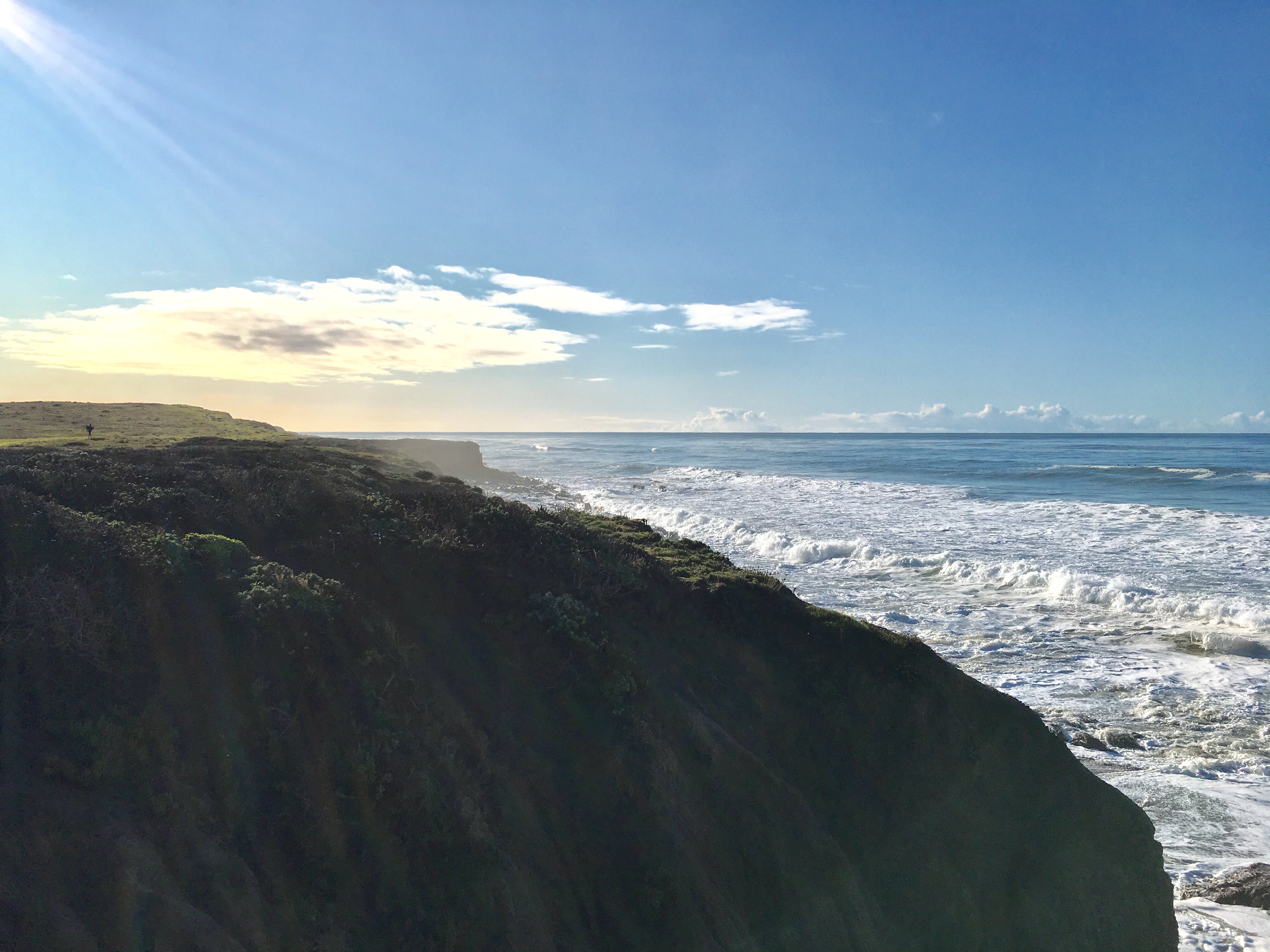
NASA-Led Study Pinpoints Areas Sinking, Rising Along California Coast

5 min read

Preparations for Next Moonwalk Simulations Underway (and Underwater)

San Simeon
Cliffs slope into the ocean in San Simeon, California. All along the state’s dynamic coastline, land is inching down and up due to natural and human-caused factors. A better understanding of this motion can help communities prepare for rising seas.
NASA/JPL-Caltech

The elevation changes may seem small — amounting to fractions of inches per year — but they can increase or decrease local flood risk, wave exposure, and saltwater intrusion.

Tracking and predicting sea level rise involves more than measuring the height of our oceans: Land along coastlines also inches up and down in elevation. Using California as a case study, a NASA-led team has shown how seemingly modest vertical land motion could significantly impact local sea levels in coming decades.

By 2050, sea levels in California are expected to increase between 6 and 14.5 inches (15 and 37 centimeters) higher than year 2000 levels. Melting glaciers and ice sheets, as well as warming ocean water, are primarily driving the rise. As coastal communities develop adaptation strategies, they can also benefit from a better understanding of the land’s role, the team said. The findings are being used in updated guidance for the state.

“In many parts of the world, like the reclaimed ground beneath San Francisco, the land is moving down faster than the sea itself is going up,” said lead author Marin Govorcin, a remote sensing scientist at NASA’s Jet Propulsion Laboratory in Southern California. 

The new study illustrates how vertical land motion can be unpredictable in scale and speed; it results from both human-caused factors such as groundwater pumping and wastewater injection, as well as from natural ones like tectonic activity. The researchers showed how direct satellite observations can improve estimates of vertical land motion and relative sea level rise. Current models, which are based on tide gauge measurements, cannot cover every location and all the dynamic land motion at work within a given region.

Local Changes

Researchers from JPL and the National Oceanic and Atmospheric Administration (NOAA) used satellite radar to track more than a thousand miles of California coast rising and sinking in new detail. They pinpointed hot spots including cities, beaches, and aquifers at greater exposure to rising seas now and in coming decades.

To capture localized motion inch by inch from space, the team analyzed radar measurements made by ESA’s (the European Space Agency’s) Sentinel-1 satellites, as well as motion velocity data from ground-based receiving stations in the Global Navigation Satellite System. Researchers compared multiple observations of the same locations made between 2015 to 2023 using a processing technique called interferometric synthetic aperture radar (InSAR).

Scientists mapped land sinking in coastal California cities
Scientists mapped land sinking (indicated in blue) in coastal California cities and in parts of the Central Valley due to factors like soil compaction, erosion, and groundwater withdrawal. They also tracked uplift hot spots (shown in red), including in Long Beach, a site of oil and gas production.
NASA Earth Observatory

Homing in on the San Francisco Bay Area specifically, San Rafael, Corte Madera, Foster City, and Bay Farm Island the team found the land subsiding at a steady rate of more than 0.4 inches (10 millimeters) per year due largely to sediment compaction. Accounting for this subsidence in the lowest-lying parts of these areas, local sea levels could rise more than 17 inches (45 centimeters) by 2050. That’s more than double the regional estimate of 7.4 inches (19 centimeters) based solely on tide gauge projections.

Not all coastal locations in California are sinking. The researchers mapped uplift hot spots of several millimeters per year in the Santa Barbara groundwater basin, which has been steadily replenishing since 2018. They also observed uplift in Long Beach, where fluid extraction and injection occur with oil and gas production.

The scientists further calculated how human-induced drivers of local land motion increase uncertainties in the sea level projections by up to 15 inches (40 centimeters) in parts of Los Angeles and San Diego counties. Reliable projections in these areas are challenging because the unpredictable nature of human activities, such as hydrocarbon production and groundwater extraction, necessitating ongoing monitoring of land motion.  

Fluctuating Aquifers, Slow-Moving Landslides

In the middle of California, in the fast-sinking parts of the Central Valley (subsiding as much as 8 inches, or 20 centimeters, per year), land motion is influenced by groundwater withdrawal. Periods of drought and precipitation can alternately draw down or inflate underground aquifers. Such fluctuations were also observed over aquifers in Santa Clara in the San Francisco Bay Area, Santa Ana in Orange County, and Chula Vista in San Diego County.

Along rugged coastal terrain like the Big Sur mountains below San Francisco and Palos Verdes Peninsula in Los Angeles, the team pinpointed local zones of downward motion associated with slow-moving landslides. In Northern California they also found sinking trends at marshlands and lagoons around San Francisco and Monterey bays, and in Sonoma County’s Russian River estuary. Erosion in these areas likely played a key factor.

Scientists, decision-makers, and the public can monitor these and other changes occurring via the JPL-led OPERA (Observational Products for End-Users from Remote Sensing Analysis) project. The OPERA project details land surface elevational changes across North America, shedding light on dynamic processes including subsidence, tectonics, and landslides.

The OPERA project will leverage additional state-of-the-art InSAR data from the upcoming NISAR (NASA-Indian Space Research Organization Synthetic Aperture Radar) mission, expected to launch within the coming months.

News Media Contacts

Jane J. Lee / Andrew Wang
Jet Propulsion Laboratory, Pasadena, Calif.
818-354-0307 / 626-379-6874
jane.j.lee@jpl.nasa.gov / andrew.wang@jpl.nasa.gov

Written by Sally Younger

2025-015

  •  

How US-Indian NISAR Satellite Will Offer Unique Window on Earth

5 min read

Preparations for Next Moonwalk Simulations Underway (and Underwater)

artist’s concept depicts the NISAR satellite orbiting Earth over Antarctica
An equal collaboration between NASA and the Indian Space Research Organisation, NISAR will offer unprecedented insights into Earth’s constantly changing land and ice surfaces using synthetic aperture radar technology. The spacecraft, depicted here in an artist’s concept, will launch from India.
NASA/JPL-Caltech

A Q&A with the lead U.S. scientist of the mission, which will track changes in everything from wetlands to ice sheets to infrastructure damaged by natural disasters.

The upcoming U.S.-India NISAR (NASA-ISRO Synthetic Aperture Radar) mission will observe Earth like no mission before, offering insights about our planet’s ever-changing surface.

The NISAR mission is a first-of-a-kind dual-band radar satellite that will measure land deformation from earthquakes, landslides, and volcanoes, producing data for science and disaster response. It will track how much glaciers and ice sheets are advancing or retreating and it will monitor growth and loss of forests and wetlands for insights on the global carbon cycle.

As diverse as NISAR’s impact will be, the mission’s winding path to launch — in a few months’ time — has also been remarkable. Paul Rosen, NISAR’s project scientist at NASA’s Jet Propulsion Laboratory in Southern California, has been there at every step. He recently discussed the mission and what sets it apart.

Paul Rosen
NISAR Project Scientist Paul Rosen of NASA’s Jet Propulsion Laboratory first traveled to India in late 2011 to discuss collaboration with ISRO scientists on an Earth-observing radar mission. NASA and ISRO signed an agreement in 2014 to develop NISAR.
NASA/JPL-Caltech

How will NISAR improve our understanding of Earth?

The planet’s surfaces never stop changing — in some ways small and subtle, and in other ways monumental and sudden. With NISAR, we’ll measure that change roughly every week, with each pixel capturing an area about half the size of a tennis court. Taking imagery of nearly all Earth’s land and ice surfaces this frequently and at such a small scale — down to the centimeter — will help us put the pieces together into one coherent picture to create a story about the planet as a living system.

What sets NISAR apart from other Earth missions?

NISAR will be the first Earth-observing satellite with two kinds of radar — an L-band system with a 10-inch (25-centimeter) wavelength and an S-band system with a 4-inch (10-centimeter) wavelength.

Whether microwaves reflect or penetrate an object depends on their wavelength. Shorter wavelengths are more sensitive to smaller objects such as leaves and rough surfaces, whereas longer wavelengths are more reactive with larger structures like boulders and tree trunks.

So NISAR’s two radar signals will react differently to some features on Earth’s surface. By taking advantage of what each signal is or isn’t sensitive to, researchers can study a broader range of features than they could with either radar on its own, observing the same features with different wavelengths.

Is this new technology?

The concept of a spaceborne synthetic aperture radar, or SAR, studying Earth’s processes dates to the 1970s, when NASA launched Seasat. Though the mission lasted only a few months, it produced first-of-a-kind images that changed the remote-sensing landscape for decades to come.

It also drew me to JPL in 1981 as a college student: I spent two summers analyzing data from the mission. Seasat led to NASA’s Shuttle Imaging Radar program and later to the Shuttle Radar Topography Mission.

What will happen to the data from the mission?

Our data products will fit the needs of users across the mission’s science focus areas — ecosystems, cryosphere, and solid Earth — plus have many uses beyond basic research like soil-moisture and water resources monitoring.

We’ll make the data easily accessible. Given the volume of the data, NASA decided that it would be processed and stored in the cloud, where it’ll be free to access.

How did the ISRO partnership come about?

We proposed DESDynI (Deformation, Ecosystem Structure, and Dynamics of Ice), an L-band satellite, following the 2007 Decadal Survey by the National Academy of Sciences. At the time, ISRO was exploring launching an S-band satellite. The two science teams proposed a dual-band mission, and in 2014 NASA and ISRO agreed to partner on NISAR.

Since then, the agencies have been collaborating across more than 9,000 miles (14,500 kilometers) and 13 time zones. Hardware was built on different continents before being assembled in India to complete the satellite. It’s been a long journey — literally.

More About NISAR

The NISAR mission is an equal collaboration between NASA and ISRO and marks the first time the two agencies have cooperated on hardware development for an Earth-observing mission. Managed for the agency by Caltech, JPL leads the U.S. component of the project and is providing the mission’s L-band SAR. NASA is also providing the radar reflector antenna, the deployable boom, a high-rate communication subsystem for science data, GPS receivers, a solid-state recorder, and payload data subsystem.

Space Applications Centre Ahmedabad, ISRO’s lead center for payload development, is providing the mission’s S-band SAR instrument and is responsible for its calibration, data processing, and development of science algorithms to address the scientific goals of the mission. U R Rao Satellite Centre in Bengaluru, which leads the ISRO components of the mission, is providing the spacecraft bus. The launch vehicle is from ISRO’s Vikram Sarabhai Space Centre, launch services are through ISRO’s Satish Dhawan Space Centre, and satellite mission operations are by ISRO Telemetry Tracking and Command Network. National Remote Sensing Centre in Hyderabad is primarily responsible for S-band data reception, operational products generation, and dissemination.

To learn more about NISAR, visit:

https://nisar.jpl.nasa.gov

News Media Contacts

Andrew Wang / Jane J. Lee
Jet Propulsion Laboratory, Pasadena, Calif.
626-379-6874 / 818-354-0307
andrew.wang@jpl.nasa.gov / jane.j.lee@jpl.nasa.gov

2025-001

  •