Reading view

Sols 4450-4451: Making the Most of a Monday

2 min read

Sols 4450-4451: Making the Most of a Monday

A grayscale, extreme wide-angle image of brightly lit Martian terrain shows an exaggerated, curved horizon in the distance, with a large mesa rising in the top center of the image, and another on the left side. The entire field between that and the image foreground is covered in rocks of varying sizes poking out of the ground at various angles, with very few patches of flat ground. Most of the rocks are very light gray, almost white, compared to the gray of the soil. The Curiosity rover is casting a shadow at the bottom of the image, and one of its wheels is faintly visible in the shadow in the lower right corner, atop some rocks.
NASA’s Mars rover Curiosity acquired this image of its brightly lit workspace and its right-front wheel in the shadows, perched on some tall rocks. The rover used its Right Front Hazcam (Front Hazard Avoidance Camera) to capture the image on sol 4449 — or Martian day 4,449 of the Mars Science Laboratory mission — Feb. 10, 2025, at 10:44:45 UTC.
NASA/JPL-Caltech

Earth planning date: Monday, Feb. 10, 2025

Last Saturday around 20:00 Pacific Standard Time I saw a 22-degree halo encircling our mostly-full Moon and Mars; an entire planet hanging in the sky between our Moon and the atmospheric phenomenon. As I took in the view I wondered what our rover was doing at that moment… turns out the Sun had just risen over Gale crater and Curiosity was still asleep, waiting for her alarm to go off in about 2.5 hours for another full day of science. 

She wouldn’t start the weekend’s drive until Monday morning about 1:30, while I was still asleep waiting for my alarm to sound at 5:15. The drive’s data arrived on Earth about 5:30, and told us we drove until our time-of-day limit for driving — stopping about 36 meters (about 118 feet) away from Friday’s location. Unfortunately, our right-front wheel was shown to be perched on some tall rocks and we couldn’t quantify the drop risk if we unstowed the arm. We decided to play it safe and keep the arm stowed instead.

Today’s two-sol plan would normally be in “nominal” sols — meaning we’d get a full day of science and a drive on the second sol — but due to some DSN downtime on Earth we moved our drive to the first sol, therefore switching to “restricted” sols a bit earlier than usual after our last soliday. Even though we couldn’t plan contact science, we’re making the most of our plan with almost 90 minutes of remote sensing. Mastcam will take an approximately 24-frame stereo mosaic of Wilkerson butte to the north, and ChemCam will shoot their laser at a rock in our workspace named “Carbon Canyon,” as well as three separate RMI mosaics! We’ll then attempt to drive until our time-of-day limit of about 15:00 local Gale time, hopefully getting us to a more stable spot on Wednesday for contact science. The second sol contains our usual dust-devil surveys with Navcam, atmospheric opacity measurements with Mastcam, and a blind LIBS on a piece of bedrock the rover chooses autonomously.

Written by Natalie Moore, Mission Operations Specialist at Malin Space Science Systems

Share

Details

Last Updated
Feb 11, 2025

Related Terms

Blog: Damp & dreary Saturday!

Talk about a temperature turnover! After taking a play out of springs playbook yesterday, today will look and feel a lot more like a winter comeback! There’s more rain on the play call sheet as well.

Temperatures today will struggle to climb – with stubborn clouds, scattered light showers, mist and drizzle will sit on either side of 40°. It’s a dreary, damp and chilly day! Some snow and a wintry mix north of the metro continues through the early morning. Little accumulations are expected as precipitation will flip to that chilly rain throughout the day.

Interestingly enough, a southwest flow develops late tonight and our temperatures turnover yet again. They will climb through late Saturday night and by sunrise Sunday, we’re talking about most of town sitting around 60°! The first half of Sunday will be much warmer than the second half – as a northerly wind shift Sunday afternoon drops temperatures back into the 40s and 50s. We’ll have passing clouds to start, with maybe a brief shower, before it turns brisk, bright and breezy. 

The cold air Sunday night settles in next week to go along with several rounds of rain – next week looks pretty soggy. Expect some passing showers on Monday with a brief wintry mix possible in the morning, then Tuesday looks a bit wetter. With the cold air in town, some snow or a wintry mix is possible to go along with chilly, soggy rain. Or at the very least we’ll be flirting with that rain snow line.

The soggy pattern will continue through Wednesday and Thursday as well, but at least by this point in time, temperatures will be climbing.

The soggy pattern could get kicked out by some dry and chilly air come Valentine’s Day!

Buckle up and enjoy the ride this weekend!

-Steve

Sols 4437-4438: Coordinating our Dance Moves

4 min read

Sols 4437-4438: Coordinating our Dance Moves

A grayscale image from the Martian surface shows very rocky, medium gray terrain in the foreground leading to a gently sloping hill on the horizon at left, and a smaller butte at image center. The ground is covered in medium-sized rocks of many shapes and angles pushing up from the soil.
NASA’s Mars rover Curiosity acquired this image using its Left Navigation Camera on sol 4435 — Martian day 4,435 of the Mars Science Laboratory mission — on Jan. 27, 2025, at 02:23:35 UTC.
NASA/JPL-Caltech

Earth planning date: Monday, Jan. 27, 2025

I was Geology and Mineralogy (Geo) Science Team lead today, and my day started with a bang and a drum roll — delivered by a rare winter thunderstorm (rare here in England, at least). I did lose power for a few minutes, but thanks to laptop batteries and phone Wi-Fi, I think no one noticed … so, shhh, don’t tell the boss!

Planning was especially interesting as we had a decision to make, whether we want to align ChemCam and APXS observations with each other and focus on one target, or whether we want two different targets. As Geo Science Team lead, it is my role to facilitate this discussion, but that is always fun — and easy. Many colleagues come with well-prepared reasons for why they want to have a certain observation in today’s plan, and I always learn something new about Mars, or geology, or both when those discussions happen. Weighing all arguments carefully, we decided for the coordinated dance of contact and remote science observations on a bedrock target we named “Desert View.” APXS will start the dance, followed by ChemCam active and one RMI image on the same location. Closing out the dance will be MAHLI, by imaging the APXS target that at this point will have the laser pits.

Such a coordinated observation will allow us to see how the rock reacts to the interaction with the laser. We have done this many times, and often learnt interesting things about the mineralogy of the rock. But more than 10 years ago, there was an even more ambitious coordination exercise: On sol 687 the imaging on a target called “Nova” was timed so that Mastcam actually captured the laser spark in the image. While that’s useful for engineering purposes, as a mineralogist I want to see the effect on the rock. Here is the result of that “spark” on target Nova on sol 687.

But back to today’s planning. Apart from the coordinated observations, ChemCam also adds to the Remote Micro Imager coverage of Gould Mesa with a vertical RMI observation that is designed to cover all the nice layers in the mesa, just like a stratigraphic column. Mastcam is looking back at the Rustic Canyon crater to get a new angle. Craters are three-dimensional and looking at it from all sides will help decipher the nature of this small crater, and also make full use of the window into the underground that it offers. Mastcam has two more mosaics, “Condor Peak” and “Boulder Basin,” which are both looking at interesting features in the landscape: Condor Peak at a newly visible butte, and Boulder Basin at bedrock targets in the near-field, to ascertain the structures and textures are still the same as they have been, or document any possible changes. Mars has surprised us before, so we try to look as often as power and other resources allow, even if only to confirm that nothing has changed. You can see the blocks that we are using for this observation in the grayscale Navigation Camera image above; we especially like it when upturned blocks give us a different view, while flat lying blocks in the same image show the “regular” perspective.

After the targeted science is completed, the rover will continue its drive along the planned route, to see what Mars has to offer on the next stop. After the drive, MARDI will take its image, and ChemCam do an autonomous observation, picking its own target. Also after the drive is a set of atmospheric observations to look at dust levels and search for dust devils. Continuous observations throughout include the DAN instrument’s observation of the surface and measurements of wind and temperature.

With that, the plan is again making best use of all the power we have available… and here in England the weather has improved, inside my power is back to normal, and outside it’s all back to the proverbial rain this small island is so famous for.

Written by Susanne Schwenzer, Planetary Geologist at The Open University

Share

Details

Last Updated
Jan 29, 2025

Related Terms

A Rover Retrospective: Turning Trials to Triumphs in 2024

3 min read

A Rover Retrospective: Turning Trials to Triumphs in 2024

A look back at a few Mars 2020 mission highlights of 2024  

Perseverance’s past year operating on the surface of Mars was filled with some of the mission’s highest highs, but also some of its greatest challenges. True to its name and its reputation as a mission that overcomes challenges, Perseverance and its team of scientists and engineers turned trials to triumphs in yet another outstanding year for the mission. There’s a lot to celebrate about Perseverance’s past year on Mars, but here are three of my top mission moments this year, in the order in which they happened. 

1. SHERLOC’s cover opens 

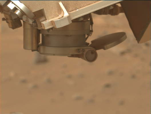
A close-up photo of an instrument on the Perseverance rover shows — against a blurred background of light tan-orange terrain — a metallic structure at the top of the frame, dusted with fine orange powder in some places. Pointing down from that is a short, barrel-shaped extension. Attached to the bottom of that is a “D”-shaped cover, attached to the mouth of the barrel on the right by a cylindrical hinge, fully opened toward the right, to an angle greater than 180 degrees.
NASA’s Mars Perseverance rover captured this image of its SHERLOC instrument (Scanning Habitable Environments with Raman & Luminescence for Organics and Chemicals), showing the cover mechanism of SHERLOC’s Autofocus and Context Imager camera (ACI) in a nearly open configuration. The rover acquired this image using its Left Mastcam-Z camera — one of a pair of cameras located high on the rover’s mast — on March 3, 2024 (sol 1079, or Martian day 1,079 of the Mars 2020 mission), at the local mean solar time of 12:18:41.
NASA/JPL-Caltech/ASU

In early January the SHERLOC instrument’s cover mechanism stopped responding during a routine attempt to acquire data on a rock outcrop in the Margin unit. After six weeks of team diagnostics, the SHERLOC instrument was declared offline and many of us feared that the instrument had met its end. In early March, the team made significant progress in driving the cover to a more open position. Then, to everyone’s surprise, the SHERLOC cover moved unexpectedly to a nearly completely open position during a movement of the arm on sol 1077. I remember staring in wonder at the image of the cover (taken on sol 1079), feeling real optimism for the first time that SHERLOC could be recovered. The team spent the next few months developing a new plan for operating SHERLOC with its cover open, and the instrument was declared back online at the end of June.  

2. A potential biosignature at Cheyava Falls  

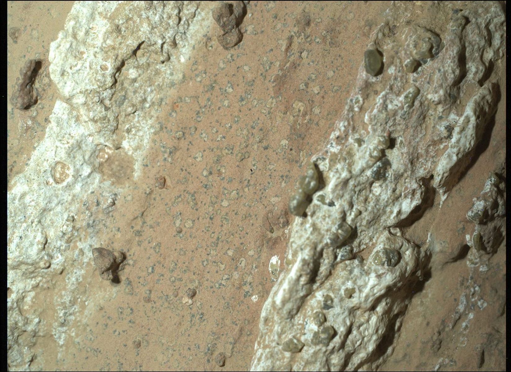
A color image of a Mars rock shows a smooth band of orange-tan down the center of the image, flanked by lumpy strips of lighter materials, smooth and in shades of light mint green and turquoise. The center portion shows innumerable small spots — light tan, outlined in very dark gray.
NASA’s Perseverance Mars rover captured this image of “leopard spots” on a rock nicknamed “Cheyava Falls” on July 18, 2024 — sol 1212. or the 1,212th Martian day of the mission. Running the length of the rock are large white calcium sulfate veins. Between those veins are bands of material whose reddish color suggests the presence of hematite, one of the minerals that gives Mars its distinctive rusty hue. Scientists are particularly interested in the millimeter-size, irregularly shaped light patches on the central reddish band (from lower left to upper right of the image) that resemble leopard spots. Perseverance captured the image using a camera called WATSON (Wide Angle Topographic Sensor for Operations and eNgineering), part of the SHERLOC (Scanning Habitable Environments with Raman and Luminescence for Organics and Chemicals) instrument suite located on the end of Perseverance’s robotic arm.
NASA/JPL-Caltech/MSSS

No top list would be complete without Perseverance’s discovery in July 2024 of a potential biosignature in the form of sub-millimeter-scale “leopard spots” at an outcrop called Cheyava Falls. These features, which formed during chemical reactions within the rock, have dark rims and light cores and occur together with organic carbon. On Earth, these chemical reactions are often driven by or associated with microbes. Although we can’t say for sure that microbes were involved in the formation of the leopard spots at Cheyava Falls, this question can be answered when Perseverance’s samples are returned to Earth. In the meantime, this rock remains one of the most compelling rocks discovered on Mars.  

3. Arrival at Witch Hazel Hill 

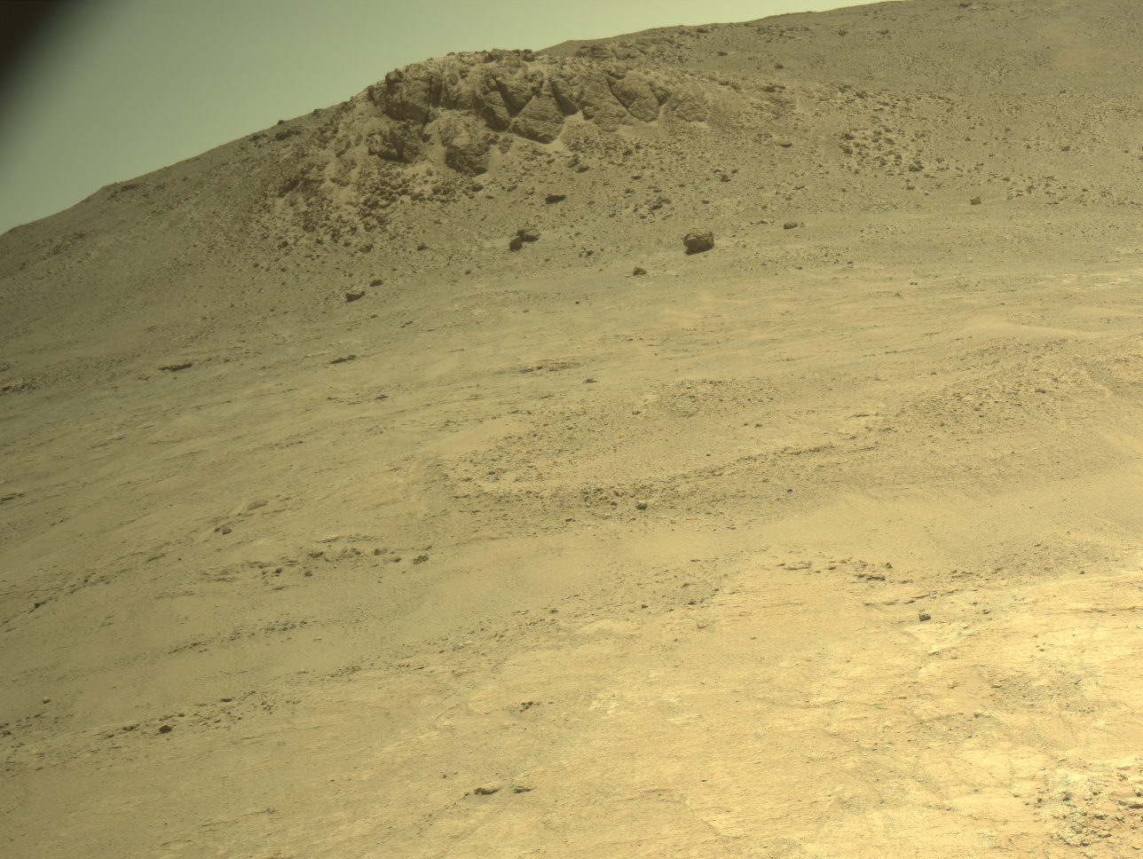
A color image from the Martian surface shows uneven yellow-tan ground leading up to the base of a hill, where the smoother ground dotted with small rocks turns into an outcropping of much larger rocks. That outcropping is on the horizon, which runs diagonally in the image, from the upper left side to the top right of the frame.
NASA’s Mars Perseverance rover acquired this image at the top of Witch Hazel Hill, of the South Arm and Minnie Hill outcrops. Perseverance used its Left Navigation Camera (Navcam) — which also aids in driving — located high on the rover’s mast. The rover captured the image on Dec. 16, 2024 (sol 1359, or Martian day 1,359 of the Mars 2020 mission), at the local mean solar time of 13:26:38.
NASA/JPL-Caltech

Closing out 2024 on a high note, in mid-December Perseverance arrived at the top of a sequence of rock exposed on the western edge of the Jezero crater rim called Witch Hazel Hill. These rocks pre-date the formation of Jezero crater and could be amongst the oldest rocks exposed on the surface of Mars. These rocks have the potential to tell us about a period of solar system history not well-preserved on our own planet Earth, and they may record important clues about the early history and habitability of Mars. Witch Hazel Hill first caught my attention during landing site selection several years ago, when we were debating the merits of landing Perseverance in Jezero versus sites outside the crater. At the time, this area seemed just out of reach for a Jezero-focused mission, so I’m thrilled that the rover is now exploring this site!   

The Mars 2020 mission had its ups and downs and a fair share of surprises during 2024, but we are looking ahead to 2025 with excitement, as Perseverance continues to explore and sample the Jezero crater rim.

Written by Katie Stack Morgan, Mars 2020 Deputy Project Scientist

Share

Details

Last Updated
Jan 08, 2025

Related Terms

Sols 4402-4415: Rover Decks and Sequence Calls for the Holidays

2 min read

Sols 4402-4415: Rover Decks and Sequence Calls for the Holidays

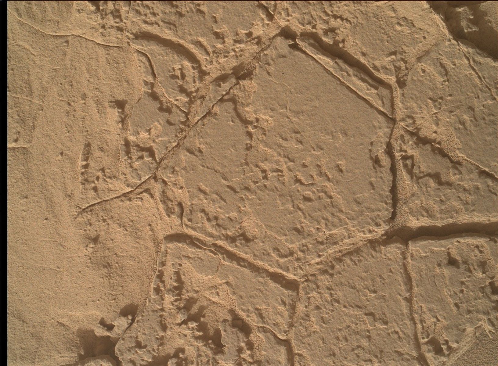
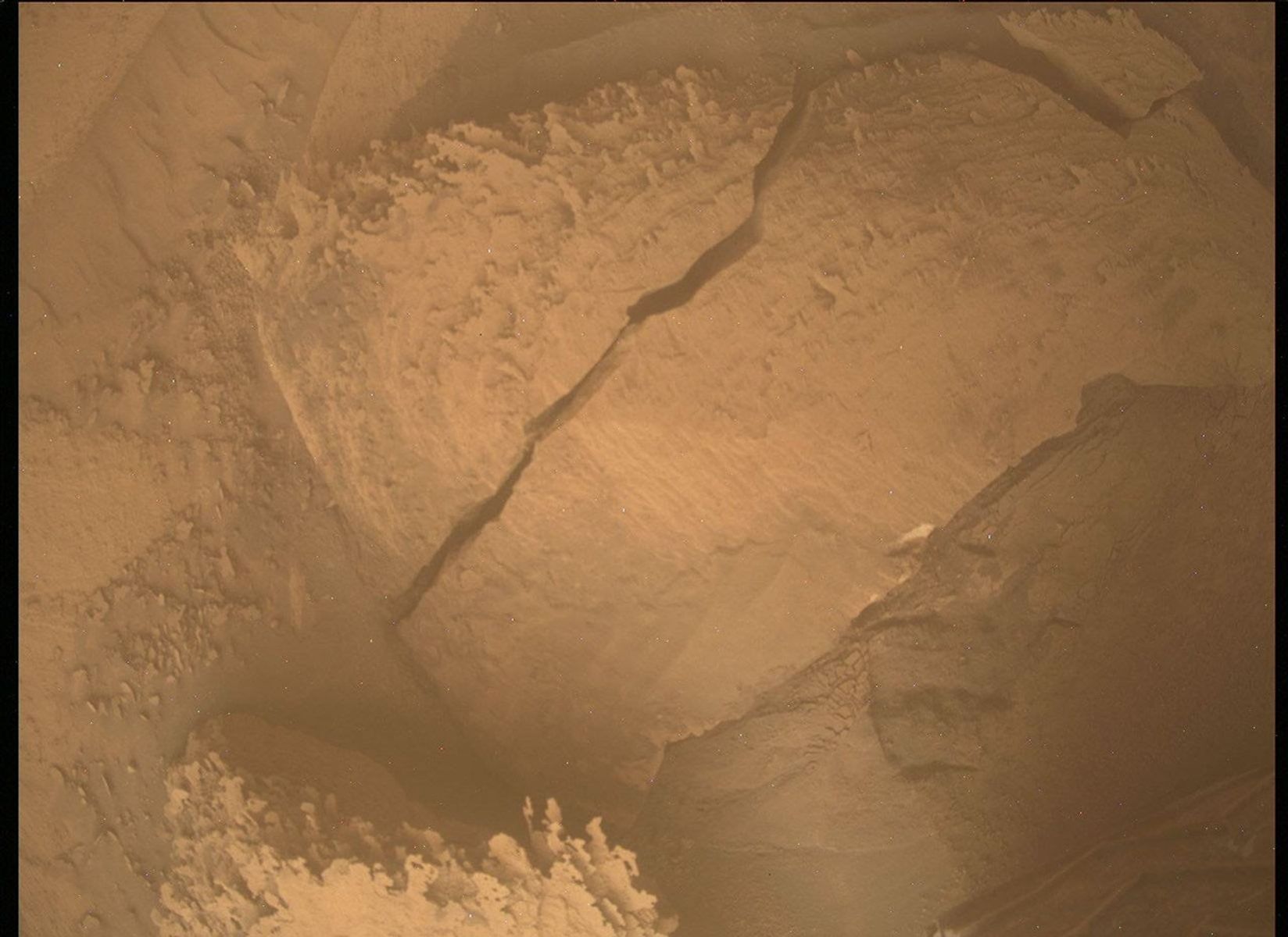
A color photograph from the Martian surface shows an overhead view of a small area of pale orange terrain, with an apparent slab of rock in the center of the image surrounded by fine, sandy soil and smaller rocks. At the center of the image is a long, wide crack in the slab, running from almost the top center of the frame toward the lower-left corner. Also, a small corner of the slab appears broken off, from an “L” shaped crack near the upper-right corner of the image.
An image under the left-front wheel of NASA’s Mars rover Curiosity shows a block that Curiosity drove over and possibly broke in half. The rover acquired this image using its Mars Descent Imager (MARDI) on sol 4396 — Martian day 4,396 of the Mars Science Laboratory mission — on Dec. 18, 2024 at 06:03:35 UTC.
NASA/JPL-Caltech/MSSS

Earth planning date: Friday, Dec. 20, 2024

Welcome to the 2024 holiday plan for Curiosity! This year we’re spanning 14 sols to last us through the Earth new year. And this is my fourth year operating Mastcam during the holidays (throwback to 2023 Marsmas!). I already knew to expect a long day, so I got my lunch prepared — blew Mars a kiss in the pre-dawn sky — and headed to work at 0600 Pacific time to start planning prep. Luckily my team got a head start on Mastcam images by including a full 360-degree panorama, post-drive, last plan, so I just had to fill in some gaps and cover some buttes with our higher-resolution camera. In total we’re only planning about 438 images this holiday, which is a pretty light haul if you can believe it! We also didn’t pass SRAP to unstow the arm (again) today, which is a bummer for science but usually makes my job easier since Mastcam doesn’t have to worry about where the arm might be during our imaging. One instrument’s coal is another instrument’s present!

So we’re doing things a little funky this holiday. We’re planning science on the first, seventh, 13th, and 14th sols — with a drive and a soliday! The hardest part of this plan was keeping it all straight in our heads.

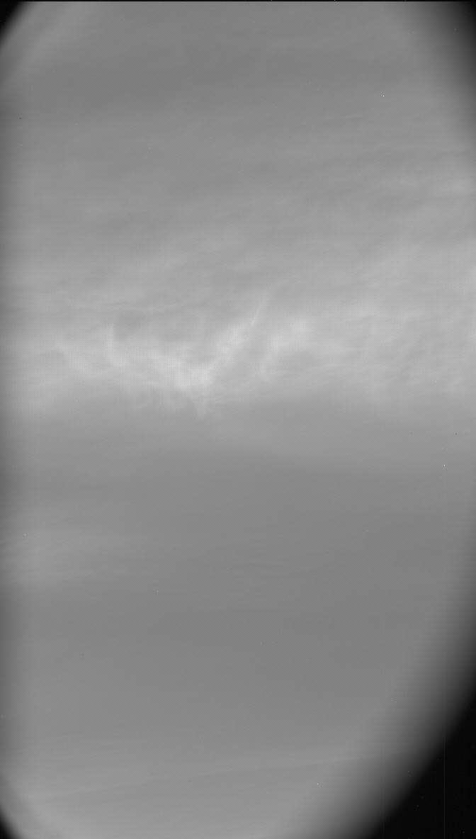
Without any contact science planned, MAHLI went on holiday early (actually, she’s been out all week!) and APXS only had to babysit an atmospheric integration, which doesn’t require any arm motion. ChemCam has three LIBS and four RMI mosaics planned, which is definitely more than usual. But actually, the highest sequence count for today goes to Mastcam! Our usual limit is around 20 sequences for complexity reasons, but today I delivered 34 total sequences. Of those 34 sequences, 10 are for tracking surface changes from wind, seven are for measuring the atmospheric opacity, three are ChemCam LIBS documentations, three are for documenting our location post-drive, two are large mosaics of Texoli and Wilkerson buttes, and two are for noctilucent cloud searching (our first attempts to find clouds this Martian winter!).

With any luck, we’ll start passing SRAP again in 2025 after another approximately 58-meter drive (about 190 feet). Until then, Earthlings — Merry Marsmas and Happy Earth New Year!

Written by Natalie Moore, Mission Operations Specialist at Malin Space Science Systems

Share

Details

Last Updated
Dec 30, 2024

Related Terms

❌