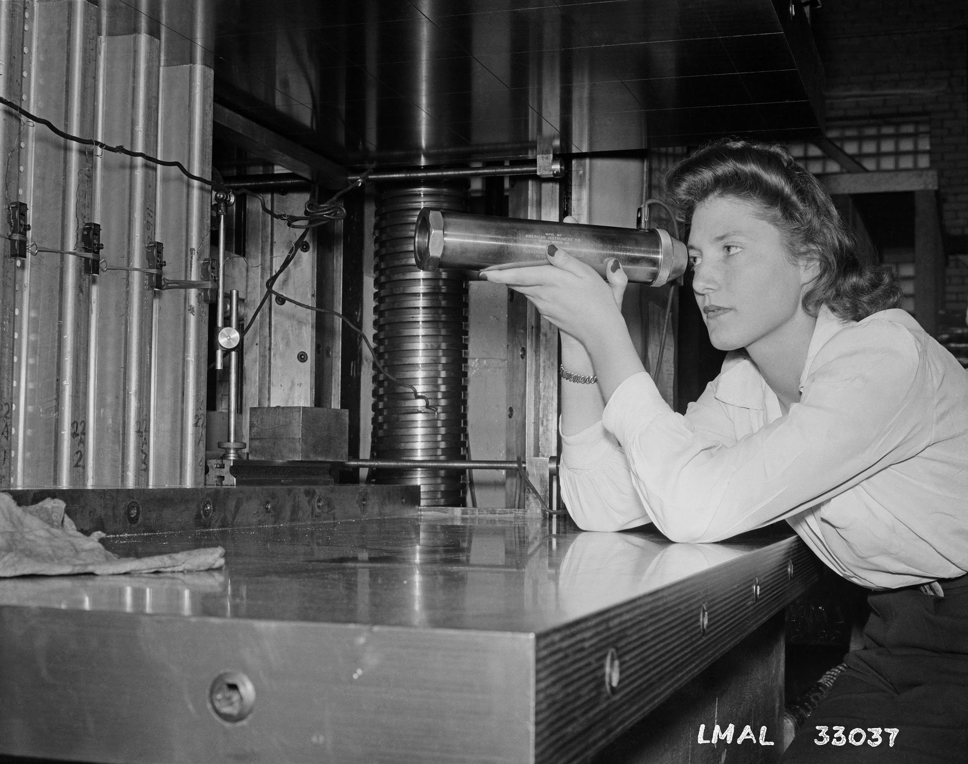
An apprentice at Langley Laboratory (now NASA’s Langley Research Center in Hampton, Virginia) inspects wind tunnel components in this image from May 15, 1943. During World War II, the National Advisory Committee for Aeronautics (NACA), the precursor to NASA, employed apprentices (which NASA has since transitioned into internships) to support meaningful jobs in data computing, testing, and mechanical work.
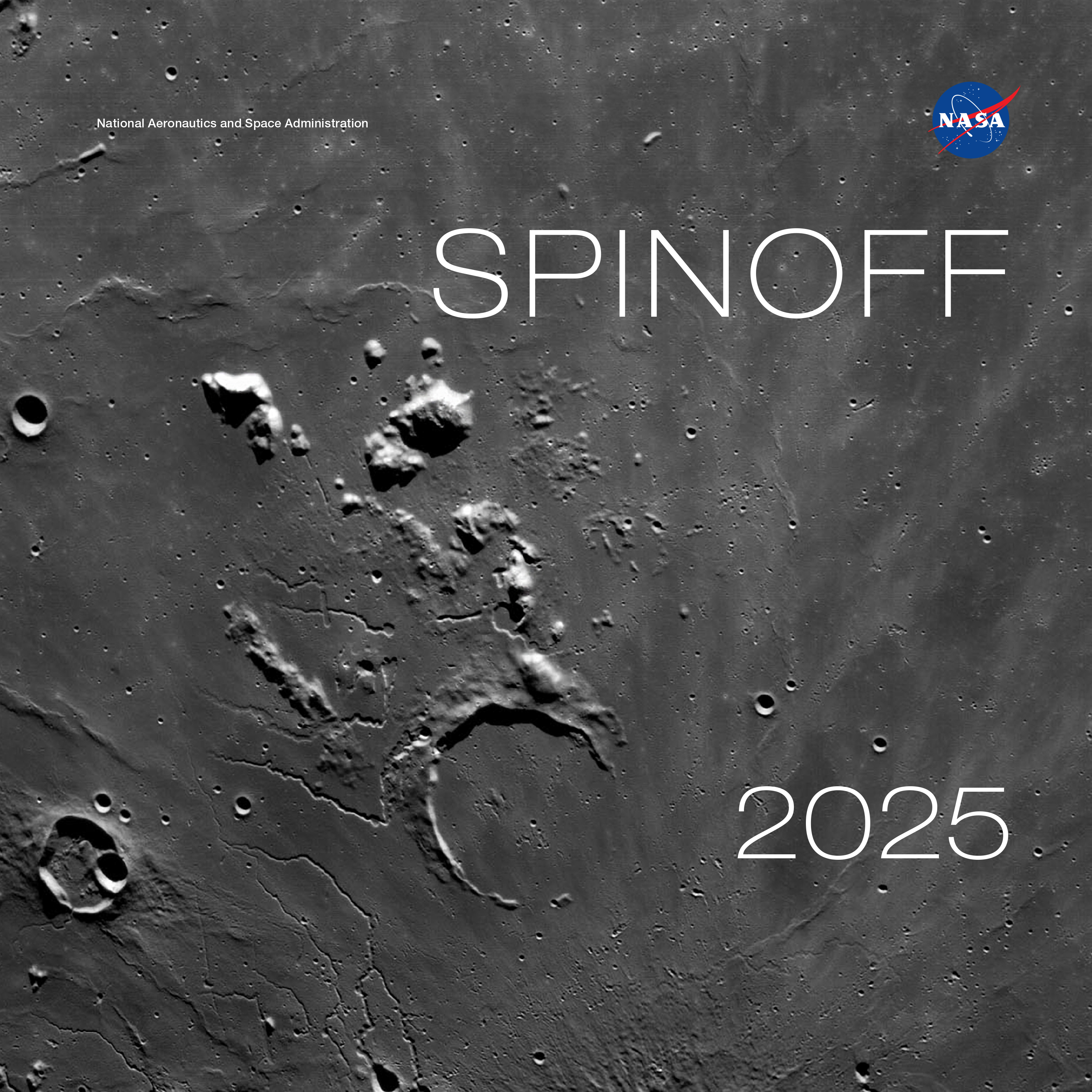
The cover of Spinoff 2025, NASA’s annual publication that chronicles commercial products born from space technology, is a detailed view of the lunar surface captured by cameras on the Orion spacecraft on a close approach of the Moon during the Artemis I mission.
Credit: NASA
The latest edition of NASA’s Spinoff publication, which highlights the successful transfer of agency technology to the commercial sector, is now available online.
For nearly 25 years, NASA has supported crew working in low Earth orbit to learn about the space environment and perform research to advance deep space exploration. Astronauts aboard the International Space Station have learned a wealth of lessons and tried out a host of new technologies. This work leads to ongoing innovations benefiting people on Earth that are featured in NASA’s annual publication.
“The work we do in space has resulted in navigational technologies, lifesaving medical advancements, and enhanced software systems that continue to benefit our lives on Earth,” said Clayton Turner, associate administrator, Space Technology Mission Directorate at NASA Headquarters in Washington. “Technologies developed today don’t just make life on our home planet easier – they pave the way to a sustained presence on the Moon and future missions to Mars.”
The Spinoff 2025 publication features more than 40 commercial infusions of NASA technologies including:
A platform enabling commercial industry to perform science on the space station, including the growth of higher-quality human heart tissue, knee cartilage, and pharmaceutical crystals that can be grown on Earth to develop new medical treatments.
An electrostatic sprayer technology to water plants without the help of gravity and now used in sanitation, agriculture, and food safety.
“Antigravity” treadmills helping people with a variety of conditions run or walk for exercise, stemming from efforts to improve astronauts’ fitness in the weightlessness of space.
Nutritional supplements originally intended to keep astronauts fit and mitigate the health hazards of a long stay in space.
As NASA continues advancing technology and research in low Earth orbit to establish a sustained presence at the Moon, upcoming lunar missions are already spinning off technologies on Earth. For example, Spinoff 2025 features a company that invented technology for 3D printing buildings on the Moon that is now using it to print large structures on Earth. Another group of researchers studying how to grow lunar buildings from fungus is now selling specially grown mushrooms and plans to build homes on Earth using the same concept.
Spinoffs produce innovative technologies with commercial applications for the benefit of all. Other highlights of Spinoff 2025 include quality control on assembly lines inspired by artificial intelligence developed to help rovers navigate Mars, innovations in origami based on math for lasers and optical computing, and companies that will help lead the way to hydrogen-based energy building on NASA’s foundation of using liquid hydrogen for rocket fuel.
“I’ve learned it’s almost impossible to predict where space technology will find an application in the commercial market,” said Dan Lockney, Technology Transfer program executive at NASA Headquarters in Washington. “One thing I can say for sure, though, is NASA’s technology will continue to spin off, because it’s our goal to advance our missions and bolster the American economy.”
This publication also features 20 technologies available for licensing with the potential for commercialization. Check out the “Spinoffs of Tomorrow” section to learn more.
Spinoff is part of NASA’s Space Technology Mission Directorate and its Technology Transfer program. Tech Transfer is charged with finding broad, innovative applications for NASA-developed technology through partnerships and licensing agreements, ensuring agency investments benefit the nation and the world.
Preparations for Next Moonwalk Simulations Underway (and Underwater)
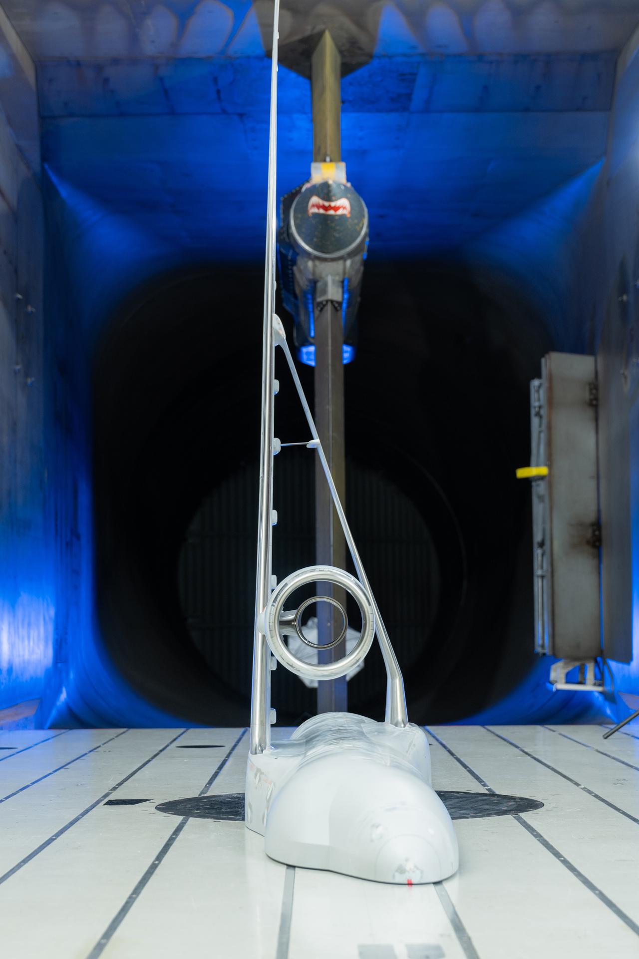
NASA’s Sustainable Flight Demonstrator project concluded wind tunnel testing in the fall of 2024. Tests on a Boeing-built X-66 model were completed at NASA’s Ames Research Center in California’s Silicon Valley in its 11-Foot Transonic Unitary Plan Facility. The model underwent tests representing expected flight conditions to obtain engineering information to influence design of the wing and provide data for flight simulators.
NASA/Brandon Torres Navarrete
NASA’s Sustainable Flight Demonstrator (SFD) project recently concluded wind tunnel tests of its X-66 semi-span model in partnership with Boeing. The model, designed to represent half the aircraft, allows the research team to generate high-quality data about the aerodynamic forces that would affect the actual X-66.
Test results will help researchers identify areas where they can refine the X-66 design – potentially reducing drag, enhancing fuel efficiency, or adjusting the vehicle shape for better flying qualities.
Tests on the Boeing-built X-66 semi-span model were completed at NASA’s Ames Research Center in California’s Silicon Valley in its 11-Foot Transonic Unitary Plan Facility. The model underwent tests representing expected flight conditions so the team could obtain engineering information to influence the design of the aircraft’s wing and provide data for flight simulators.
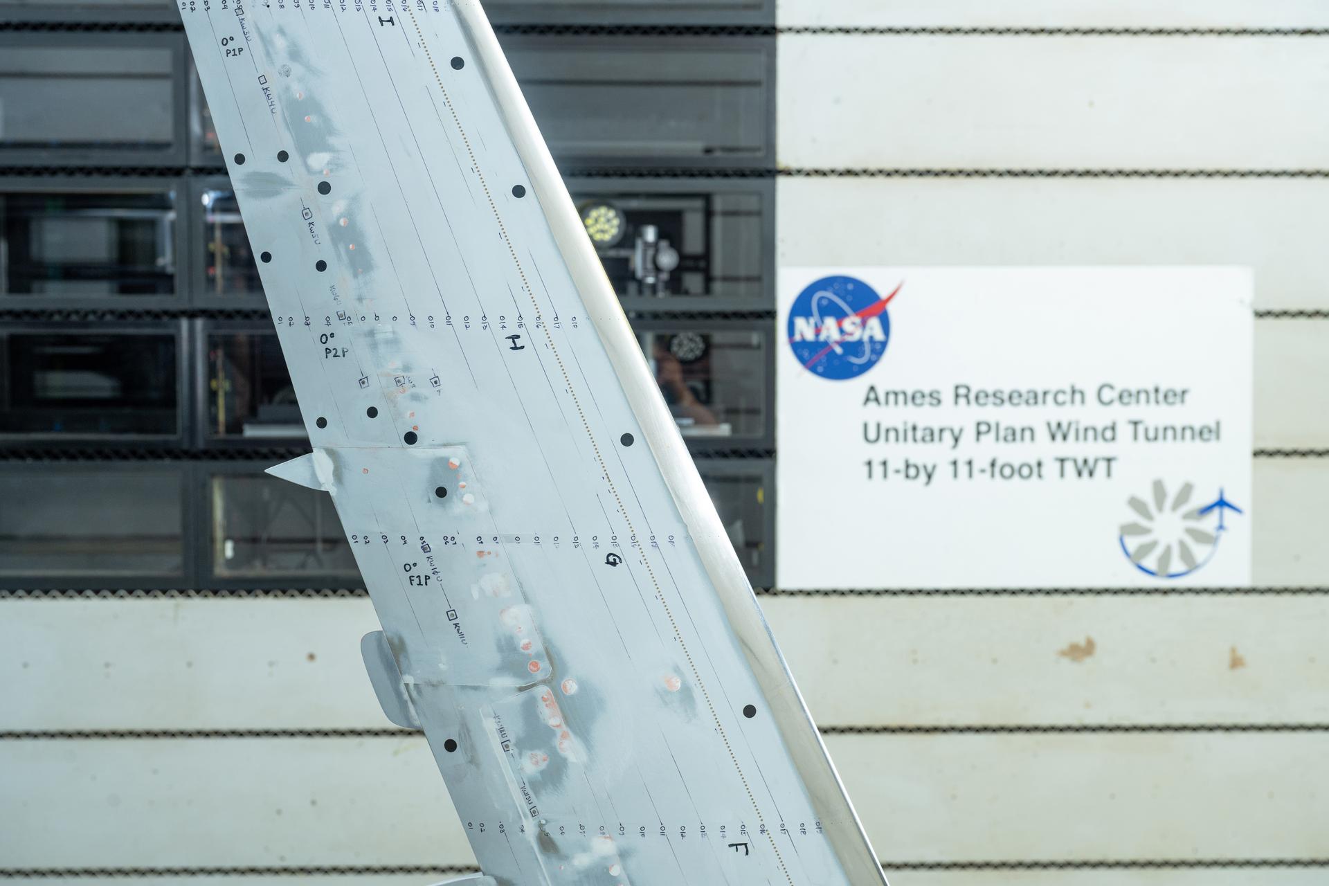
NASA’s Sustainable Flight Demonstrator project concluded wind tunnel testing in the fall of 2024. Tests on a Boeing-built X-66 model were completed at NASA’s Ames Research Center in California’s Silicon Valley in its 11-Foot Transonic Unitary Plan Facility. Pressure points, which are drilled holes with data sensors attached, are installed along the edge of the wing and allow engineers to understand the characteristics of airflow and will influence the final design of the wing.
NASA/Brandon Torres Navarrete
Semi-span tests take advantage of symmetry. The forces and behaviors on a model of half an aircraft mirror those on the other half. By using a larger half of the model, engineers increase the number of surface pressure measurements. Various sensors were placed on the wing to measure forces and movements to calculate lift, drag, stability, and other important characteristics.
The semi-span tests follow earlier wind tunnel work at NASA’s Langley Research Center in Hampton, Virginia, using a smaller model of the entire aircraft. Engineers will study the data from all of the X-66 wind tunnel tests to determine any design changes that should be made before fabrication begins on the wing that will be used on the X-66 itself.
The SFD project is NASA’s effort to develop more efficient aircraft configurations as the nation moves toward aviation that’s more economically, societally, and environmentally sustainable. The project seeks to provide information to inform the next generation of single-aisle airliners, the most common aircraft in commercial aviation fleets around the world. Boeing and NASA are partnering to develop the X-66 experimental demonstrator aircraft.
An FVR90 unmanned aerial vehicle (UAV) lifts off from the Monterey Bay Academy Airport near Watsonville, California, during the Advanced Capabilities for Emergency Response Operations (ACERO) Shakedown Test in November 2024.
NASA/Don Richey
NASA is collaborating with the wildfire community to provide tools for some of the most challenging aspects of firefighting – particularly aerial nighttime operations.
In the future, agencies could more efficiently use drones, both remotely piloted and fully autonomous, to help fight wildfires. NASA recently tested technologies with teams across the country that will enable aircraft – including small drones and helicopters outfitted with autonomous technology for remote piloting – to monitor and fight wildfires 24 hours a day, even during low-visibility conditions.
Current aerial firefighting operations are limited to times when aircraft have clear visibility – otherwise, pilots run the risk of flying into terrain or colliding with other aircraft. NASA-developed airspace management technology will enable drones and remotely piloted aircraft to operate at night, expanding the window of time responders have to aerially suppress fires.
“We’re aiming to provide new tools – including airspace management technologies – for 24-hour drone operations for wildfire response,” said Min Xue, project manager of the Advanced Capabilities for Emergency Response Operations (ACERO) project within NASA’s Aeronautics Research Mission Directorate. “This testing will provide valuable data to inform how we mature this technology for eventual use in the field.”
Over the past year, ACERO researchers developed a portable airspace management system (PAMS) drone pilots can use to safely send aircraft into wildfire response operations when operating drones from remote control systems or ground control stations.
Each PAMS, roughly the size of a carry-on suitcase, is outfitted with a computer for airspace management, a radio for sharing information among PAMS units, and an Automatic Dependent Surveillance-Broadcast receiver for picking up nearby air traffic – all encased in a durable and portable container.
NASA software on the PAMS allows drone pilots to avoid airborne collisions while remotely operating aircraft by monitoring and sharing flight plans with other aircraft in the network. The system also provides basic fire location and weather information. A drone equipped with a communication device acts as an airborne communication relay for the ground-based PAMS units, enabling them to communicate with each other without relying on the internet.
Engineers fly a drone at NASA’s Langley Research Center in Hampton, Virginia, to test aerial coordination capabilities.
NASA/Mark Knopp
To test the PAMS units’ ability to share and display vital information, NASA researchers placed three units in different locations outside each other’s line of sight at a hangar at NASA’s Ames Research Center in California’s Silicon Valley. Researchers stationed at each unit entered a flight plan into their system and observed that each unit successfully shared flight plans with the others through a mesh radio network.
Next, researchers worked with team members in Virginia to test an aerial communications radio relay capability.
Researchers outfitted a long-range vertical takeoff and landing aircraft with a camera, computer, a mesh radio, and an Automatic Dependent Surveillance-Broadcast receiver for air traffic information. The team flew the aircraft and two smaller drones at NASA’s Langley Research Center in Hampton, Virginia, purposely operating them outside each other’s line of sight.
The mesh radio network aboard the larger drone successfully connected with the small drones and multiple radio units on the ground.
Yasmin Arbab front-right frame, Alexey Munishkin, Shawn Wolfe, with Sarah Mitchell, standing behind, works with the Advanced Capabilities for Emergency Response Operations (ACERO) Portable Airspace Management System (PAMS) case at the Monterey Bay Academy Airport near Watsonville, California.
NASA/Don Richey
NASA researchers then tested the PAMS units’ ability to coordinate through an aerial communications relay to simulate what it could be like in the field.
At Monterey Bay Academy Airport in Watsonville, California, engineers flew a winged drone with vertical takeoff and landing capability by Overwatch Aero, establishing a communications relay to three different PAMS units. Next, the team flew two smaller drones nearby.
Researchers tested the PAMS units’ ability to receive communications from the Overwatch aircraft and share information with other PAMS units. Pilots purposely submitted flight plans that would conflict with each other and intentionally flew the drones outside preapproved flight plans.
The PAMS units successfully alerted pilots to conflicting flight plans and operations outside preapproved zones. They also shared aircraft location with each other and displayed weather updates and simulated fire location data.
The test demonstrated the potential for using PAM units in wildfire operations.
“This testing is a significant step towards improving aerial coordination during a wildfire,” Xue said. “These technologies will improve wildfire operations, reduce the impacts of large wildfires, and save more lives,” Xue said.
This year, the team will perform a flight evaluation to further mature these wildfire technologies. Ultimately, the project aims to transfer this technology to the firefighting community community.
This work is led by the ACERO project under NASA’s Aeronautics Research Mission Directorate and supports the agency’s Advanced Air Mobility mission.
NASA Space Tech’s Favorite Place to Travel in 2025: The Moon!
The first image from space of Firefly's Blue Ghost mission 1 lunar lander as it begins its 45-day transit period to the Moon.
Credits: Firefly Aerospace
NASA Space Technology has big travel plans for 2025, starting with a trip to the near side of the Moon!
Among ten groundbreaking NASA science and technology demonstrations, two technologies are on a ride to survey lunar regolith – also known as “Moon dust” – to better understand surface interactions with incoming lander spacecraft and payloads conducting experiments on the surface. These dust demonstrations and the data they’re designed to collect will help support future lunar missions.
Blue Ghost Mission 1 launched at 1:11 a.m. EST aboard a SpaceX Falcon 9 rocket from Launch Complex 39A at the agency’s Kennedy Space Center in Florida. The company is targeting a lunar landing on Sunday, March 2.
The first image from space of Firefly’s Blue Ghost mission 1 lunar lander as it begins its 45-day transit period to the Moon.
Firefly Aerospace
NASA Space Technology on Blue Ghost Mission 1
NASA’sElectrodynamic Dust Shield (EDS) will lift, transport, and remove particles using electric fields to repel and prevent hazardous lunar dust accumulation on surfaces. The agency’s Stereo Camera for Lunar Plume-Surface Studies (SCALPSS)technology will use stereo imaging to capture the impact of rocket plumes on lunar regolith as the lander descends to the Moon’s surface, returning high-resolution images that will help in creating models to predict regolith erosion – an important task as bigger, heavier payloads are delivered to the Moon in close proximity to each other.
The EDS and SCALPSS technologies will be delivered to the Moon on Firefly’s first Blue Ghost mission, named Ghost Riders in the Sky, as part of NASA’s CLPS (Commercial Lunar Payload Services) initiative. Its landing target is a 300-mile-wide basin located on the Moon’s near side, called Mare Crisium – a large, dark, basaltic plain that filled an ancient asteroid impact. First-of-their-kind experiments will deploy after landing to gather important data in a broad spectrum of areas including geophysical characteristics, global navigation, radiation tolerant computing, and the behavior of lunar regolith.
Replicating the Moon’s harsh environment on Earth is a significant challenge because of extreme temperatures, low gravity, radiation, and dusty surface. The CLPS initiative provides unprecedented access to the lunar surface, allowing us to demonstrate technologies in the exact conditions they were designed for. Missions like Blue Ghost Mission 1 are a true game changer for NASA technology advancement and demonstration.”
Michael Johansen
Flight Demonstrations Lead for NASA’s Game Changing Development program
Dust particles scatter during an experiment for the Electrodynamic Dust Shield in a laboratory at NASA’s Kennedy Space Center in Florida.
NASA
NASA’s Stereo Camera for Lunar Plume-Surface Studies technology integrated on Firefly’s Blue Ghost lander.
Firefly Aerospace
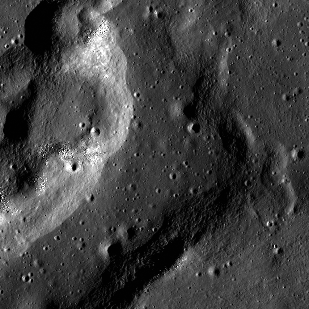
A complex wrinkle ridge in Mare Crisium at low Sun, seen in an image captured by the Lunar Reconnaissance Orbiter Camera.
NASA/GSFC/Arizona State University
Understanding regolith
The Moon’s dusty environment was one of the greatest challenges astronauts faced during Apollo Moon missions, posing hazards to lunar surface systems, space suits, habitats, and instrumentation. What was learned from those early missions – and from thousands of experiments conducted on Earth and in space since – is that successful surface missions require the ability to eliminate dust from all kinds of systems. Lunar landings, for example, cause lunar dust to disperse in all directions and collect on everything that lands there with it. This is one of the reasons such technologies are important to understand. The SCALPSS technology will study the dispersion of lunar dust, while EDS will demonstrate a solution to mitigate it.
Getting this new data on lunar regolith with be pivotal for our understanding of the lunar surface. We’ve long known that lunar dust is a huge challenge. The Lunar Surface Innovation Initiative has enabled us to initiate lunar dust mitigation efforts across the agency, working with industry and international partners. The lunar science, exploration, and technology communities are eager to have new quantitative data, and to prove laboratory experiments and develop technology solutions.”
Kristen John
Technical Integration Lead for NASA’s Lunar Surface Innovation Initiative (LSII)
[VIDEO] Dust on the lunar surface is a significant hazard for systems and astronauts living and working on the Moon. NASA space technologies are developing solutions to retire hurdles in this capability area.
NASA Space Technology
Dust mitigation technology has come a long way, but we still have a lot to learn to develop surface systems and infrastructure for more complex missions. LSII is actively engaged in this effort, working with the lunar community across sectors to expand knowledge and design new approaches for future technologies. Working alongside the Lunar Surface Innovation Consortium, LSII has a unique opportunity to take a holistic look at dust’s role in the development of surface infrastructure with other key capability areas including in-situ resource utilization, surface power, and surviving the lunar night.
Learning from the the Moon benefits Mars science and exploration
Capabilities for minimizing dust interaction are as important for future missions on Mars as it is for missions on the Moon. Like the Moon, Mars is also covered with regolith, also called Martian dust or Martian soil, but the properties are different than lunar regolith, both in shape and mineralogy. The challenges Mars rovers have encountered with Martian regolith have provided great insight into the challenges we will face during lunar surface missions. Learning is interwoven and beneficial to future missions whether hundreds of thousands of miles from Earth, on the Moon, or millions, on Mars.
Scientist-astronaut Harrison Schmitt, Apollo 17 lunar module pilot, uses an adjustable sampling scoop to retrieve lunar samples during the second Apollo 17 extravehicular activity (EVA).
NASA
NASA’s Perseverance Mars rover snagged two samples of regolith – broken rock and dust – on Dec. 2 and 6, 2022. This set of images, taken by the rover’s left navigation camera, shows Perseverance’s robotic arm over the two holes left after the samples were collected.
NASA/JPL-Caltech
Learn more from a planetary scientist about how science factors into lunar dust mitigation technologies:
Preparations for Next Moonwalk Simulations Underway (and Underwater)
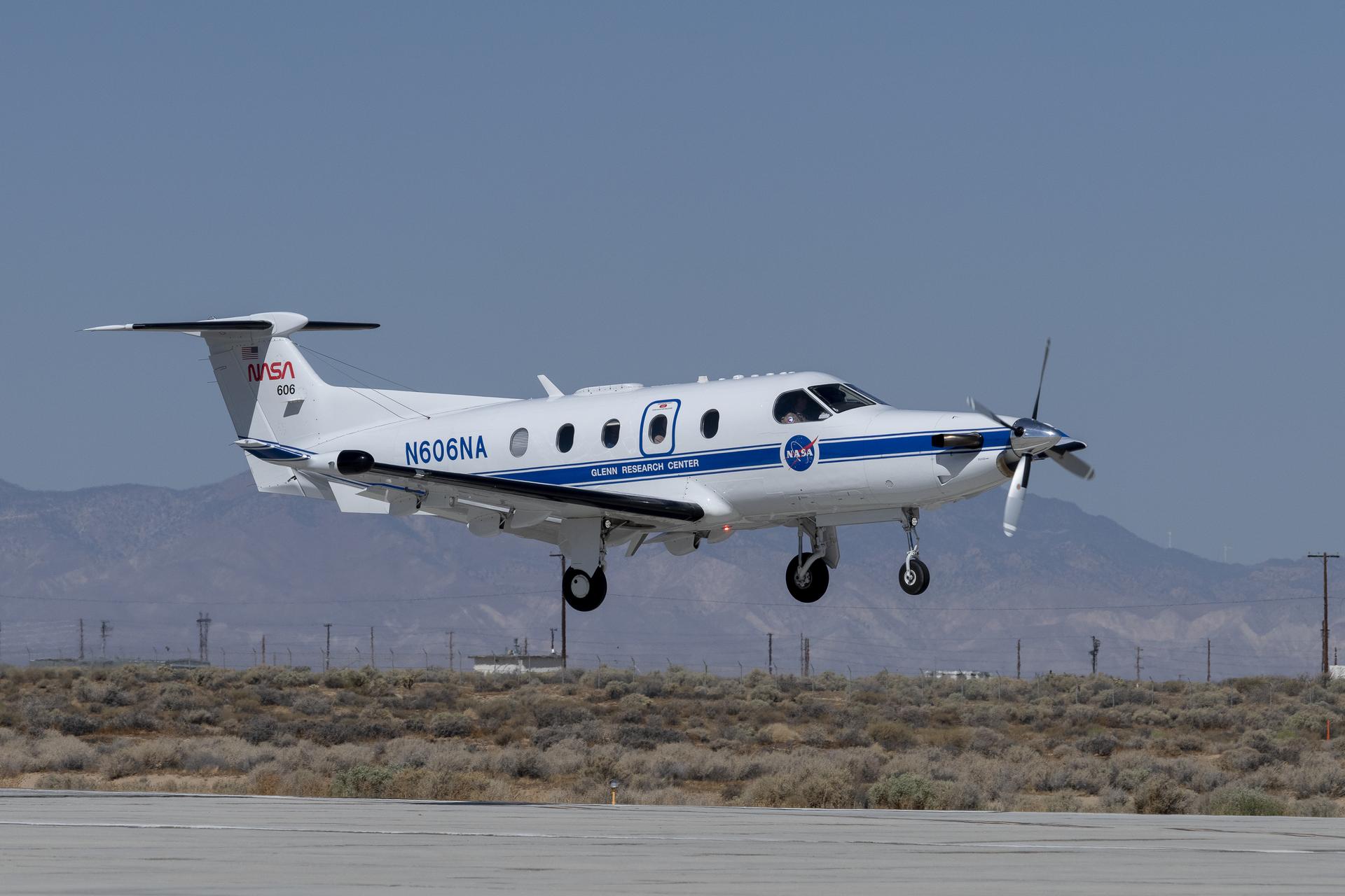
Equipped with state-of-the-art technology to test and evaluate communication, navigation, and surveillance systems NASA’s Pilatus PC-12 performs touch-and-go maneuvers over a runway at NASA’s Armstrong Flight Research Center in Edwards, California on Sept. 23, 2024. Researchers will use the data to understand Automatic Dependent Surveillance-Broadcast (ADS-B) signal loss scenarios for air taxi flights in urban areas. To prepare for ADS-B test flights pilots and crew from NASA Armstrong and NASA’s Glenn Research Center in Cleveland, ran a series of familiarization flights. These flights included several approach and landings, with an emphasis on avionics, medium altitude air-work with steep turns, slow flight and stall demonstrations.
NASA/Steve Freeman
As air taxis, drones, and other innovative aircraft enter U.S. airspace, systems that communicate an aircraft’s location will be critical to ensure air traffic safety.
The Federal Aviation Administration (FAA) requires aircraft to communicate their locations to other aircraft and air traffic control in real time using an Automatic Dependent Surveillance-Broadcast (ADS-B) system. NASA is currently evaluating an ADS-B system’s ability to prevent collisions in a simulated urban environment. Using NASA’s Pilatus PC-12 aircraft, researchers are investigating how these systems could handle the demands of air taxis flying at low altitudes through cities.
When operating in urban areas, one particular challenge for ADS-B systems is consistent signal coverage. Like losing cell-phone signal, air taxis flying through densely populated areas may have trouble maintaining ADS-B signals due to distance or interference. If that happens, those vehicles become less visible to air traffic control and other aircraft in the area, increasing the likelihood of collisions.
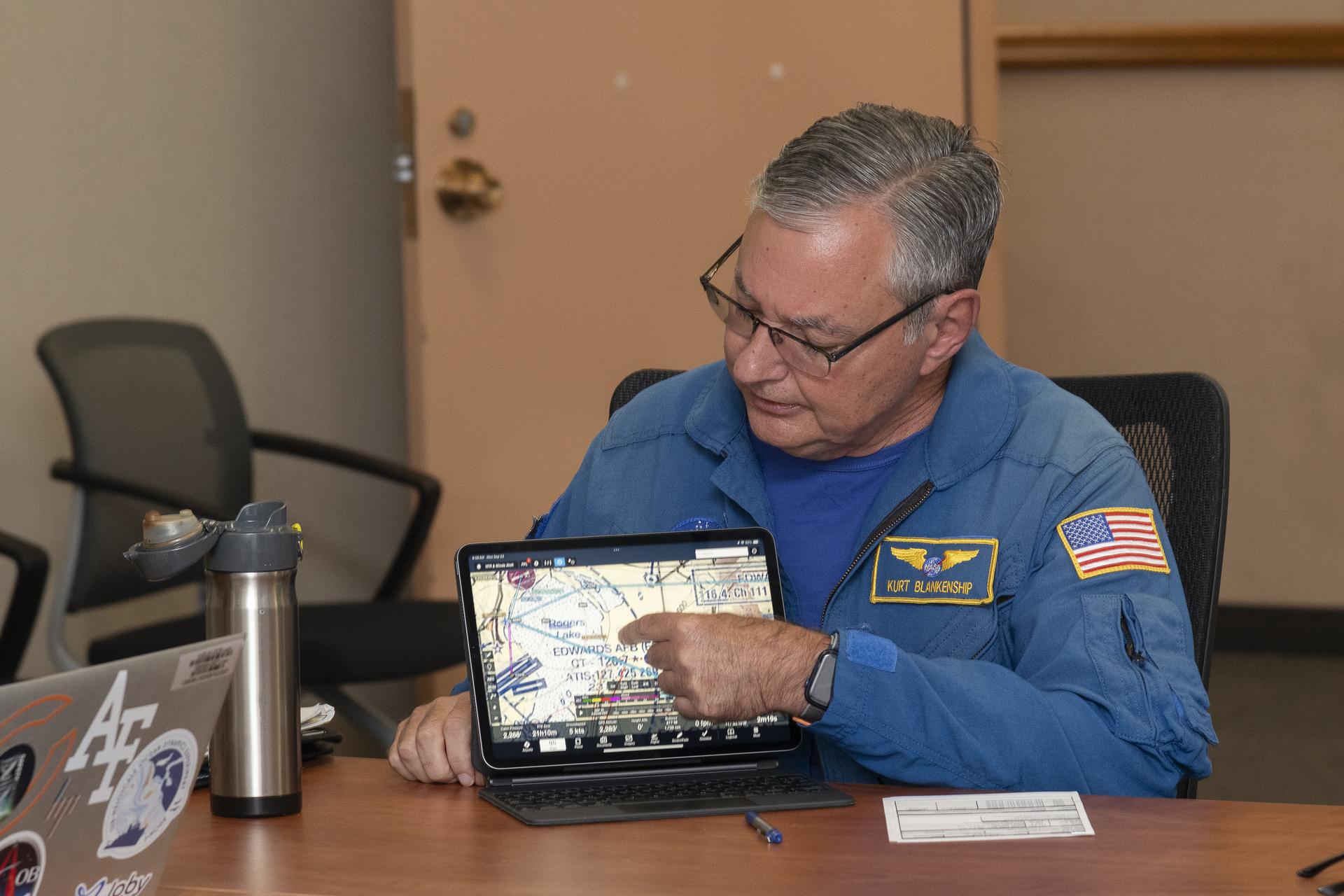
NASA pilot Kurt Blankenship maps out flight plans during a pre-flight brief. Pilots, crew, and researchers from NASA’s Armstrong Flight Research Center in Edwards, California and NASA’s Glenn Research Center in Cleveland are briefed on the flight plan to gather Automatic Dependent Surveillance-Broadcast signal data between the aircraft and ping-Stations on the ground at NASA Armstrong. These flights are the first cross-center research activity with the Pilatus-PC-12 at NASA Armstrong.
NASA/Steve Freeman
To simulate the conditions of an urban flight area and better understand signal loss patterns, NASA researchers established a test zone at NASA’s Armstrong Flight Research Center in Edwards, California, on Sept. 23 and 24, 2024.
Flying in the agency’s Pilatus PC-12 in a grid pattern over four ADS-B stations, researchers collected data on signal coverage from multiple ground locations and equipment configurations. Researchers were able to pinpoint where signal dropouts occurred from the strategically placed ground stations in connection to the plane’s altitude and distance from the stations. This data will inform future placement of additional ground stations to enhance signal boosting coverage.
“Like all antennas, those used for ADS-B signal reception do not have a constant pattern,” said Brad Snelling, vehicle test team chief engineer for NASA’s Air Mobility Pathfinders project. “There are certain areas where the terrain will block ADS-B signals and depending on the type of antenna and location characteristics, there are also flight elevation angles where reception can cause signal dropouts,” Snelling said. “This would mean we need to place additional ground stations at multiple locations to boost the signal for future test flights. We can use the test results to help us configure the equipment to reduce signal loss when we conduct future air taxi flight tests.”
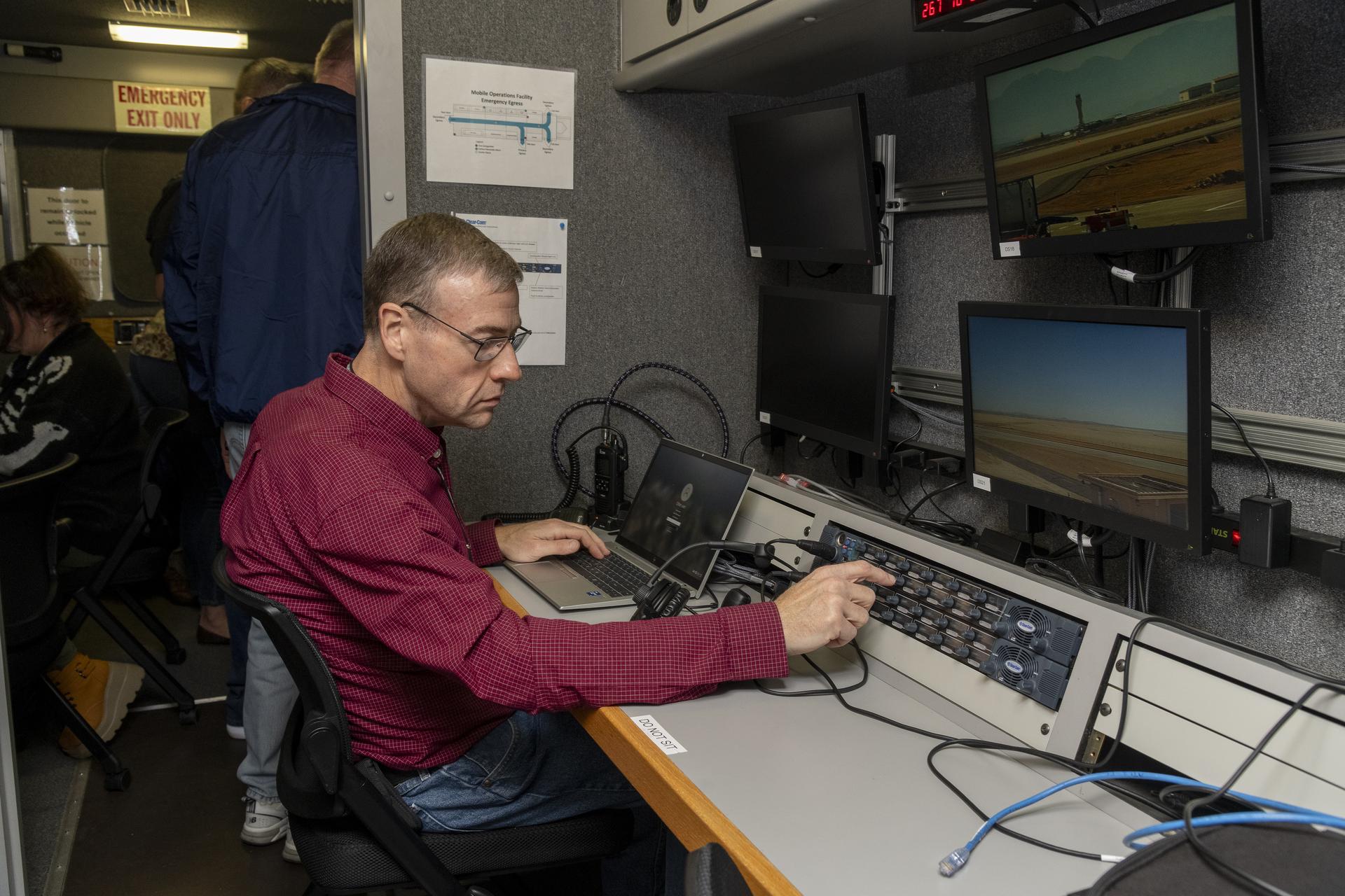
Working in the Mobile Operations Facility at NASA’s Armstrong Flight Research Center in Edwards, California, NASA Advanced Air Mobility researcher Dennis Iannicca adjusts a control board to capture Automatic Dependent Surveillance-Broadcast (ADS-B) data during test flights. The data will be used to understand ADS-B signal loss scenarios for air taxi flights in urban areas.
NASA/Steve Freeman
The September flights at NASA Armstrong built upon earlier tests of ADS-B in different environments. In June, researchers at NASA’s Glenn Research Center in Cleveland flew the Pilatus PC-12 and found a consistent ADS-B signal between the aircraft and communications antennas mounted on the roof of the center’sAerospace Communications Facility. Data from these flights helped researchers plan out the recent tests at NASA Armstrong. In December 2020, test flights performed under NASA’s Advanced Air Mobility National Campaign used an OH-58C Kiowa helicopter and ground-based ADS-B stations at NASA Armstrong to collect baseline signal information.
NASA’s research in ADS-B signals and other communication, navigation, and surveillance systems will help revolutionize U.S. air transportation. Air Mobility Pathfinders researchers will evaluate the data from the three separate flight tests to understand the different signal transmission conditions and equipment needed for air taxis and drones to safely operate in the National Air Space. NASA will use the results of this research to design infrastructure to support future air taxi communication, navigation, and surveillance research and to develop new ADS-B-like concepts for uncrewed aircraft systems.
Elton W. Miller, chief of aerodynamics at what is now NASA’s Langley Research Center in Hampton, Virginia, stands in the entrance cone of the Propeller Research Tunnel in this Sept. 9, 1926, photo. In front of the entrance is the Sperry M-1 Messenger, the first full-scale airplane tested in the tunnel.
The Propeller Research Tunnel, or PRT as it came to be known, was only the National Advisory Committee for Aeronautics’ third wind tunnel and the largest one built. The PRT was in fact the largest tunnel built at that time anywhere in the world. Designed to accommodate a full-scale propeller, the throat of the PRT was 20 feet in diameter.
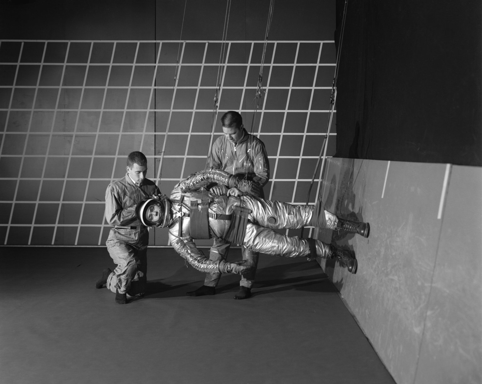
In this Dec. 11, 1963, image, technicians prepare a test subject for studies on the Reduced Gravity Walking Simulator at NASA’s Langley Research Center in Hampton, Virginia. This position meant that a person’s legs experienced only one sixth of their weight, which was the equivalent of being on the Moon’s surface. The simulator was used to study the subject while walking, jumping, or running; it also was used to train Apollo astronauts for completing tasks in the unfamiliar lunar environment.
The effect was quite realistic. When asked what it was like to land on the Moon, Neil Armstrong replied, “Like Langley.”
Preparations for Next Moonwalk Simulations Underway (and Underwater)
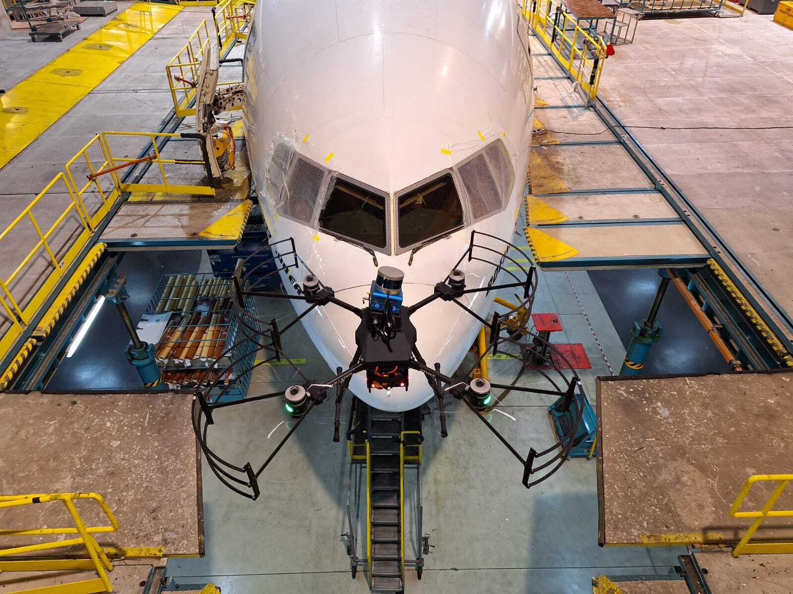
A Boeing 777-300ER aircraft is being inspected by one of Near Earth Autonomy’s drones Feb. 2, 2024, at an Emirates Airlines facility in Dubai, United Arab Emirates.
Near Earth Autonomy
A small business called Near Earth Autonomy developed a time-saving solution using drones for pre-flight checks of commercial airliners through a NASA Small Business Innovation Research (SBIR) program and a partnership with The Boeing Company.
Before commercial airliners are deemed safe to fly before each trip, a pre-flight inspection must be completed. This process can take up to four hours, and can involve workers climbing around the plane to check for any issues, which can sometimes result in safety mishaps as well as diagnosis errors.
With NASA and Boeing funding to bolster commercial readiness, Near Earth Autonomy developed a drone-enabled solution, under their business unit Proxim, that can fly around a commercial airliner and gather inspection data in less than 30 minutes. The drone can autonomously fly around an aircraft to complete the inspection by following a computer-programmed task card based on the Federal Aviation Administration’s rules for commercial aircraft inspection. The card shows the flight path the drone’s software needs to take, enabling aircraft workers with a new tool to increase safety and efficiency.
“NASA has worked with Near Earth Autonomy on autonomous inspection challenges in multiple domains,” says Danette Allen, NASA senior leader for autonomous systems.
“We are excited to see this technology spin out to industry to increase efficiencies, safety, and accuracy of the aircraft inspection process for overall public benefit.”
The photos collected from the drone are shared and analyzed remotely, which allows experts in the airline maintenance field to support repair decisions faster from any location. New images can be compared to old images to look for cracks, popped rivets, leaks, and other common issues.
The user can ask the system to create alerts if an area needs to be inspected again or fails an inspection. Near Earth Autonomy estimates that using drones for aircraft inspection can save the airline industry an average of $10,000 per hour of lost earnings during unplanned time on the ground.
Over the last six years, Near Earth Autonomy completed several rounds of test flights with their drone system on Boeing aircraft used by American Airlines and Emirates Airlines.
NASA’s Small Business Innovation Research / Small Business Technology Transfer program, managed by the agency’s Space Technology Mission Directorate, aims to bolster American ingenuity by supporting innovative ideas put forth by small businesses to fulfill NASA and industry needs. These research needs are described in annual SBIR solicitations and target technologies that have significant potential for successful commercialization.
Small business concerns with 500 or fewer employees, or small businesses partnering with a non-profit research institution such as a university or a research laboratory can apply to participate in the NASA SBIR/STTR program.