Normal view

Before yesterdayMain stream

NASA Uses New Technology to Understand California Wildfires

28 February 2025 at 16:42

3 min read

Preparations for Next Moonwalk Simulations Underway (and Underwater)

A scientific instrument sits on top of a metal surface. The instrument is composed of several metal blocks, cables, tubes, and dials. The central block appears to have a microchip and is connected by cables and tubes to the adjacent blocks. Some electrical wiring protrudes from parts of the instrument.
The Compact Fire Infrared Radiance Spectral tracker, or C-FIRST, is managed an operated by NASA’s Jet Propulsion Laboratory, and supported by NASA’s Earth Science Technology Office. Combining state-of-the-art imaging technology with a compact design, C-FIRST enables scientists to gather data about fires and their impacts on ecosystems with greater accuracy and speed than other instruments. C-FIRST was developed as a spaceborne instrument, and flew onboard NASA’s B200 aircraft in January 2025 to conduct an airborne test.
NASA/JPL-Caltech

The January wildfires in California devastated local habitats and communities. In an effort to better understand wildfire behavior, NASA scientists and engineers tried to learn from the events by testing new technology.

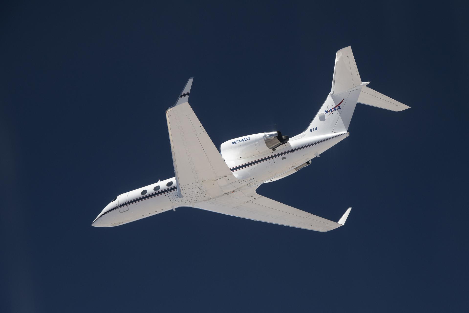
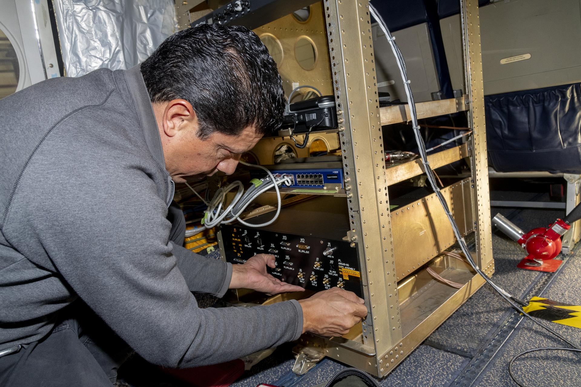
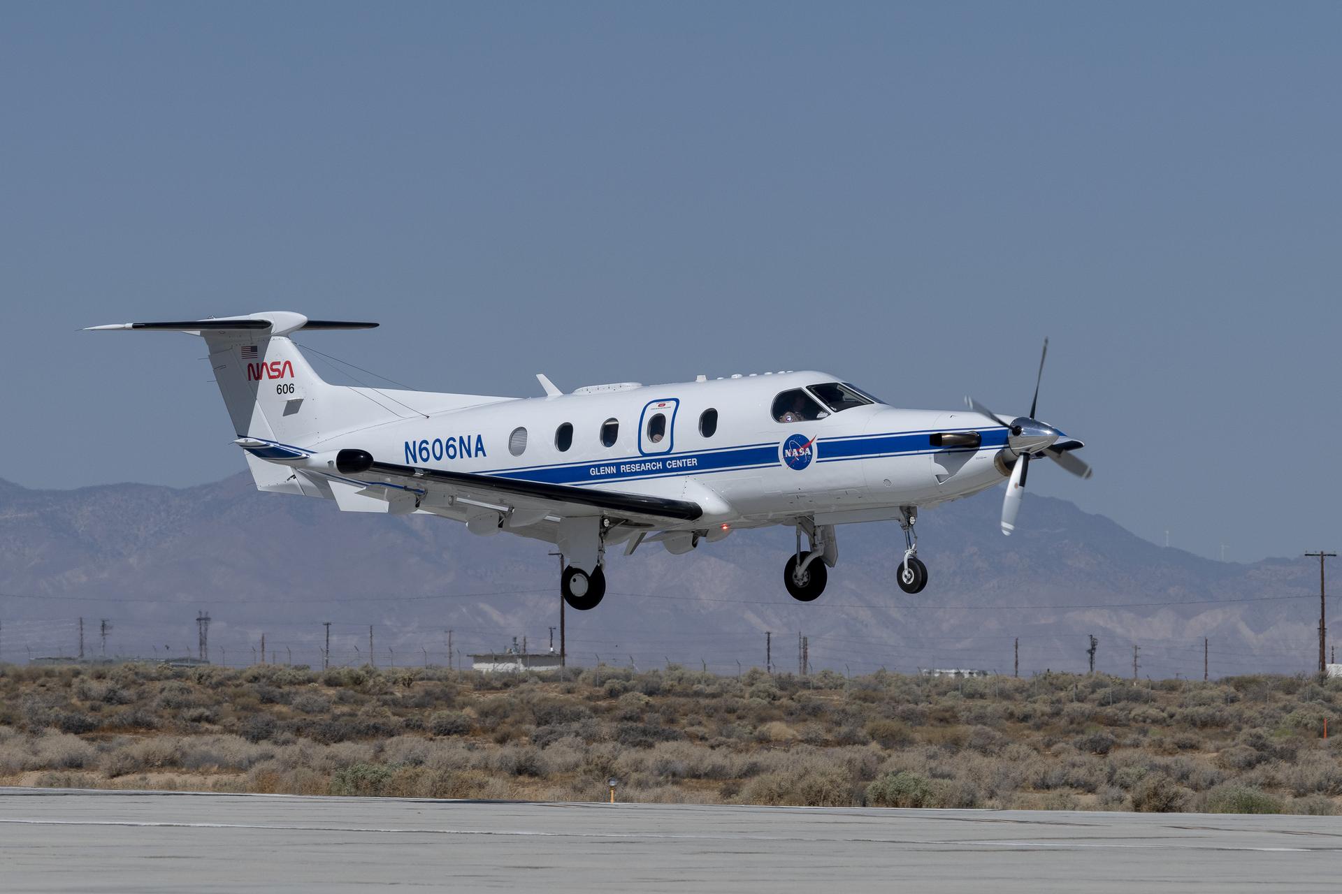
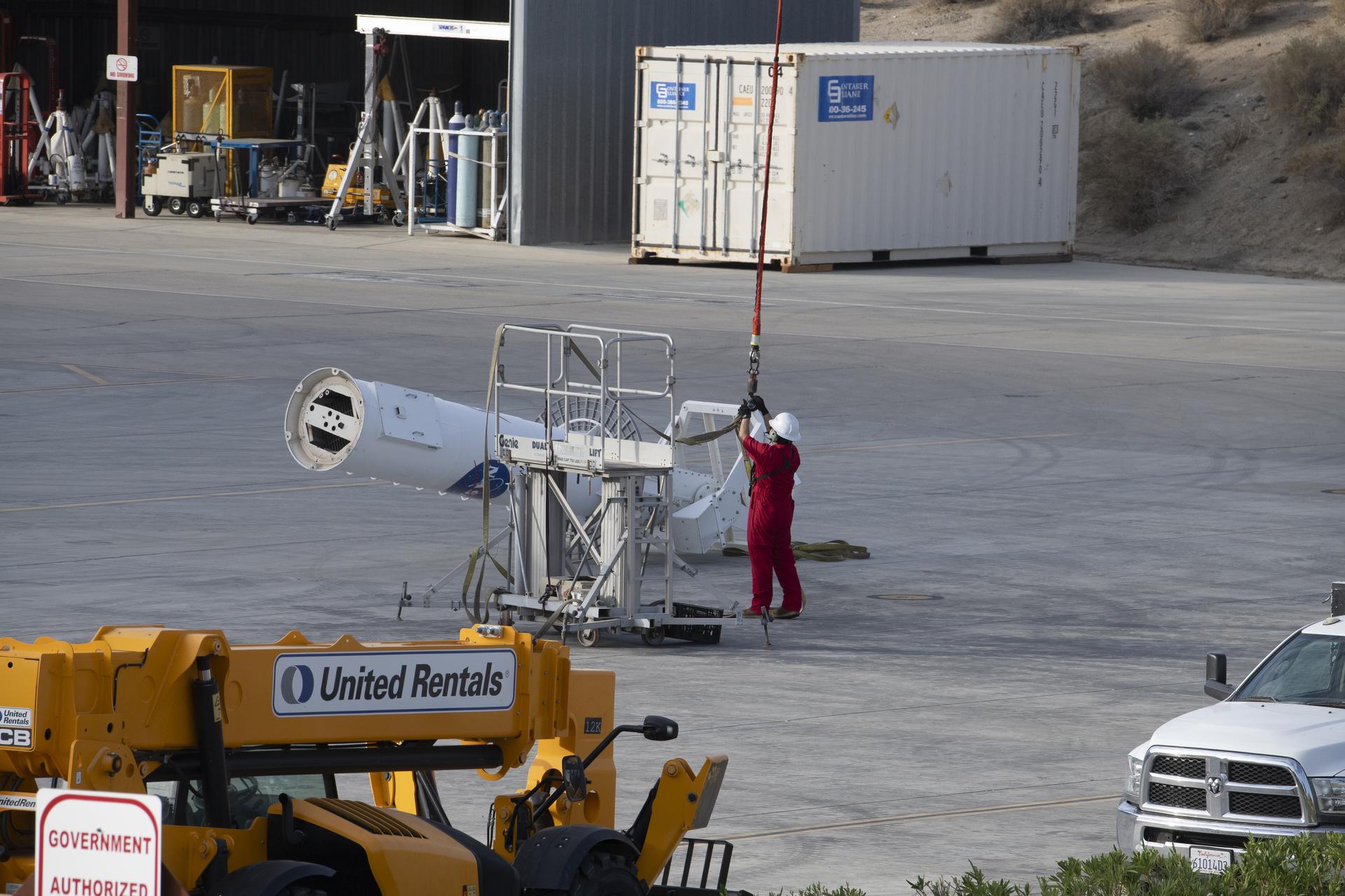
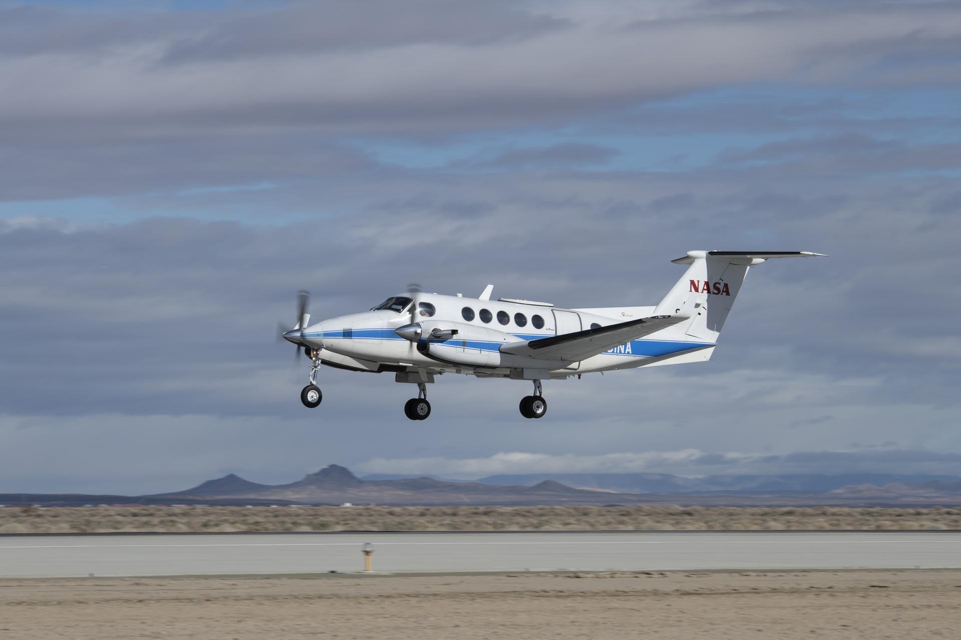
The new instrument, the Compact Fire Infrared Radiance Spectral Tracker (c-FIRST), was tested when NASA’s B200 King Air aircraft flew over the wildfires in the Pacific Palisades and Altadena, California. Based at NASA’s Armstrong Flight Research Center in Edwards, California, the aircraft used the c-FIRST instrument to observe the impacts of the fires in near real-time. Due to its small size and ability to efficiently simulate a satellite-based mission, the B200 King Air is uniquely suited for testing c-FIRST.

Managed and operated by NASA’s Jet Propulsion Laboratory in Southern California, c-FIRST gathers thermal infrared images in high-resolution and other data about the terrain to study the impacts of wildfires on ecology. In a single observation, c-FIRST can capture the full temperature range across a wide area of wildland fires – as well as the cool, unburned background – potentially increasing both the quantity and quality of science data produced.

“Currently, no instrument is able to cover the entire range of attributes for fires present in the Earth system,” said Sarath Gunapala, principal investigator for c-FIRST at NASA JPL. “This leads to gaps in our understanding of how many fires occur, and of crucial characteristics like size and temperature.”

For decades, the quality of infrared images has struggled to convey the nuances of high-temperature surfaces above 1,000 degrees Fahrenheit (550 degrees Celsius). Blurry resolution and light saturation of infrared images has inhibited scientists’ understanding of an extremely hot terrain, and thereby also inhibited wildfire research. Historically, images of extremely hot targets often lacked the detail scientists need to understand the range of a fire’s impacts on an ecosystem.

NASA’s Armstrong Flight Research Center in Edwards, California, flew the B200 King Air in support of the Signals of Opportunity Synthetic Aperture Radar (SoOpSAR) campaign on Feb. 27, 2023.
NASA/Steve Freeman

To address this, NASA’s Earth Science Technology Office supported JPL’s development of the c-FIRST instrument, combining state-of-the-art imaging technology with a compact and efficient design. When c-FIRST was airborne, scientists could detect smoldering fires more accurately and quickly, while also gathering important information on active fires in near real-time.

“These smoldering fires can flame up if the wind picks up again,” said Gunapala. “Therefore, the c-FIRST data set could provide very important information for firefighting agencies to fight fires more effectively.”

For instance, c-FIRST data can help scientists estimate the likelihood of a fire spreading in a certain landscape, allowing officials to more effectively monitor smoldering fires and track how fires evolve. Furthermore, c-FIRST can collect detailed data that can enable scientists to understand how an ecosystem may recover from fire events.

“The requirements of the c-FIRST instrument meet the flight profile of the King Air,” said KC Sujan, operations engineer for the B200 King Air. “The c-FIRST team wanted a quick integration, the flight speed in the range 130 and 140 knots on a level flight, communication and navigation systems, and the instruments power requirement that are perfectly fit for King Air’s capability.”

By first testing the instrument onboard the B200 King Air, the c-FIRST team can evaluate its readiness for future satellite missions investigating wildfires. On a changing planet where wildfires are increasingly common, instruments like c-FIRST could provide data that can aid firefighting agencies to fight fires more effectively, and to understand the ecosystemic impacts of extreme weather events.

NASA Remembers Long-Time Civil Servant John Boyd

26 February 2025 at 15:45
Portrait of John Boyd, known to many as Jack, in a blue shirt with a black background
Portrait of John Boyd, whose contributions to NASA spanned more than 70 years.
Credit: NASA

John Boyd, known to many as Jack and whose career spanned more than seven decades in a multitude of roles across NASA as well as its predecessor, the National Advisory Committee for Aeronautics (NACA), died Feb. 20. He was 99. Born in 1925, and raised in Danville, Virginia, he was a long-time resident of Saratoga, California.

Boyd is being remembered by many across the agency, including Dr. Eugene Tu, director, NASA’s Ames Research Center in California’s Silicon Valley, where Boyd spent most of his career.

“Jack brought an energy, optimism, and team-based approach to solving some of the greatest technological challenges humanity has ever faced, which remains part of our culture to this day,” said Tu. “There are few careers as wide-ranging and impactful as Jack’s.”

In 1947, Boyd began his career at the then-called Ames Aeronautical Laboratory in Moffett Field, California, as an aeronautical engineer working to design and test various wing shapes using the center’s 1-by-3-foot supersonic wind tunnel. Boyd continued conducting research in wind tunnels, testing designs that led to dramatic increases in the efficiency of the supersonic B-58 bomber, as well as the F-102 and F-106 fighters.

In 1958, just before Ames became part of a newly established NASA, Boyd recalled thinking, “Maybe someday we’ll go out into the far blue yonder, and if we do, what are we going to fly? How are we going to bring it back into the atmosphere safely?” He and a team of engineers turned their attention to studying the dynamics of high-speed projectiles in hypervelocity ranges, filled with different mixtures of gases to mimic the atmospheres of Mars and Venus, in preparation for sending spacecraft out into space and safely back again or to the surface of other worlds.

By the mid-60s, Boyd was promoted into leadership and tapped to become deputy director for Aeronautics and Flight Systems at NASA Ames. In the late 1960s, as America was redefining its space exploration goals and sending humans to the Moon, Boyd served as the center’s lead to assist NASA Headquarters in Washington consolidate and create new research programs.

In 1979, Boyd served as the deputy director at NASA’s Dryden Flight Research Center (now known as NASA’s Armstrong Flight Research Center) in Edwards, California, and prepared the center for its role as a landing site for the space shuttle. He briefly returned to Ames before heading to NASA Headquarters to be associate administrator for management under James M. Beggs. Boyd left government service in 1985, taking a position as chancellor for research and an adjunct professor of aerodynamics, engineering, and the history of spaceflight for the University of Texas System.

Boyd returned to NASA and California’s Silicon Valley in 1993, inspiring students through educational outreach initiatives, and serving as the senior advisor to the director, senior advisor for history, and the center ombudsman until his retirement in 2020.

Boyd credits his interest in airplanes to a cousin who was a paratrooper and gave him a ride in a biplane in the 1940s. In 1943, he enrolled and became the first in his family to earn a degree with a bachelor of science in aeronautical engineering from Virginia Polytechnic Institute and State University in Blacksburg, Virginia. He was a recipient of the NASA Exceptional Service Award, the NASA Outstanding Leadership Award, the NASA Equal Employment Opportunity Medal, the Presidential Rank of Meritorious Executive, the NASA Distinguished Service Medal, the Army Command Medal, and the NASA Headquarters History Award. He also was a Fellow of the American Institute of Aeronautics and Astronautics and a Sloan Fellow at Stanford University.

“The agency and the nation thank and honor Jack as a member of the NASA family and the highest exemplar of a public servant who believed investing in others is the greatest contribution one can make,” added Tu. “He will be deeply missed.”

For more information about NASA Ames, visit:

https://www.nasa.gov/ames

-end-

Cheryl Warner
Headquarters, Washington
202-358-1600
cheryl.m.warner@nasa.gov

Rachel Hoover
Ames Research Center, Silicon Valley
650-604-4789
rachel.hoover@nasa.gov

NASA’s Advancements in Space Continue Generating Products on Earth  

12 February 2025 at 13:20
The cover of Spinoff 2025, NASA's annual publication that chronicles commercial products born from space technology, is a detailed view of the lunar surface captured by cameras on the Orion spacecraft on a close approach of the Moon during the Artemis I mission.
The cover of Spinoff 2025, NASA’s annual publication that chronicles commercial products born from space technology, is a detailed view of the lunar surface captured by cameras on the Orion spacecraft on a close approach of the Moon during the Artemis I mission.
Credit: NASA

The latest edition of NASA’s Spinoff publication, which highlights the successful transfer of agency technology to the commercial sector, is now available online.

For nearly 25 years, NASA has supported crew working in low Earth orbit to learn about the space environment and perform research to advance deep space exploration. Astronauts aboard the International Space Station have learned a wealth of lessons and tried out a host of new technologies. This work leads to ongoing innovations benefiting people on Earth that are featured in NASA’s annual publication.  

“The work we do in space has resulted in navigational technologies, lifesaving medical advancements, and enhanced software systems that continue to benefit our lives on Earth,” said Clayton Turner, associate administrator, Space Technology Mission Directorate at NASA Headquarters in Washington. “Technologies developed today don’t just make life on our home planet easier – they pave the way to a sustained presence on the Moon and future missions to Mars.” 

The Spinoff 2025 publication features more than 40 commercial infusions of NASA technologies including: 

  • A platform enabling commercial industry to perform science on the space station, including the growth of higher-quality human heart tissue, knee cartilage, and pharmaceutical crystals that can be grown on Earth to develop new medical treatments.  
  • An electrostatic sprayer technology to water plants without the help of gravity and now used in sanitation, agriculture, and food safety.  
  • “Antigravity” treadmills helping people with a variety of conditions run or walk for exercise, stemming from efforts to improve astronauts’ fitness in the weightlessness of space.  
  • Nutritional supplements originally intended to keep astronauts fit and mitigate the health hazards of a long stay in space.  

As NASA continues advancing technology and research in low Earth orbit to establish a sustained presence at the Moon, upcoming lunar missions are already spinning off technologies on Earth. For example, Spinoff 2025 features a company that invented technology for 3D printing buildings on the Moon that is now using it to print large structures on Earth. Another group of researchers studying how to grow lunar buildings from fungus is now selling specially grown mushrooms and plans to build homes on Earth using the same concept.  

Spinoffs produce innovative technologies with commercial applications for the benefit of all. Other highlights of Spinoff 2025 include quality control on assembly lines inspired by artificial intelligence developed to help rovers navigate Mars, innovations in origami based on math for lasers and optical computing, and companies that will help lead the way to hydrogen-based energy building on NASA’s foundation of using liquid hydrogen for rocket fuel.  

“I’ve learned it’s almost impossible to predict where space technology will find an application in the commercial market,” said Dan Lockney, Technology Transfer program executive at NASA Headquarters in Washington. “One thing I can say for sure, though, is NASA’s technology will continue to spin off, because it’s our goal to advance our missions and bolster the American economy.”  

This publication also features 20 technologies available for licensing with the potential for commercialization. Check out the “Spinoffs of Tomorrow” section to learn more.

Spinoff is part of NASA’s Space Technology Mission Directorate and its Technology Transfer program. Tech Transfer is charged with finding broad, innovative applications for NASA-developed technology through partnerships and licensing agreements, ensuring agency investments benefit the nation and the world.  

To read the latest issue of Spinoff, visit: 

https://spinoff.nasa.gov

-end-

Jasmine Hopkins
Headquarters, Washington
321-432-4624
jasmine.s.hopkins@nasa.gov

NASA Tests in Simulated Lunar Gravity to Prep Payloads for Moon

4 February 2025 at 15:04

3 min read

Preparations for Next Moonwalk Simulations Underway (and Underwater)

Launch of Blue Origins New Shepard suborbital rocket system.
Launch of Blue Origin’s New Shepard suborbital rocket system on Feb. 4, 2025. During the flight test, the capsule at the top detached from the booster and spun at approximately 11 rpm to simulate lunar gravity for the NASA-supported payloads inside.
Blue Origin

The old saying — “Practice makes perfect!” — applies to the Moon too. On Tuesday, NASA gave 17 technologies, instruments, and experiments the chance to practice being on the Moon… without actually going there. Instead, it was a flight test aboard a vehicle adapted to simulate lunar gravity for approximately two minutes.

The test began on February 4, 2025, with the 10:00 a.m. CST launch of Blue Origin’s New Shepard reusable suborbital rocket system in West Texas. With support from NASA’s Flight Opportunities program, the company, headquartered in Kent, Washington, enhanced the flight capabilities of its New Shepard capsule to replicate the Moon’s gravity — which is about one-sixth of Earth’s — during suborbital flight.

“Commercial companies are critical to helping NASA prepare for missions to the Moon and beyond,” said Danielle McCulloch, program executive of the agency’s Flight Opportunities program. “The more similar a test environment is to a mission’s operating environment, the better. So, we provided substantial support to this flight test to expand the available vehicle capabilities, helping ensure technologies are ready for lunar exploration.”

NASA’s Flight Opportunities program not only secured “seats” for the technologies aboard this flight — for 16 payloads inside the capsule plus one mounted externally — but also contributed to New Shepard’s upgrades to provide the environment needed to advance their readiness for the Moon and other space exploration missions.

“An extended period of simulated lunar gravity is an important test regime for NASA,” said Greg Peters, program manager for Flight Opportunities. “It’s crucial to reducing risk for innovations that might one day go to the lunar surface.”

Watch highlights from the Feb. 4, 2025 lunar gravity flight test.
Blue Origin

One example is the LUCI (Lunar-g Combustion Investigation) payload, which seeks to understand material flammability on the Moon compared to Earth. This is an important component of astronaut safety in habitats on the Moon and could inform the design of potential combustion devices there. With support from the Moon to Mars Program Office within the Exploration Systems Development Mission Directorate, researchers at NASA’s Glenn Research Center in Cleveland, together with Voyager Technologies, designed LUCI to measure flame propagation directly during the Blue Origin flight.

The rest of the NASA-supported payloads on this Blue Origin flight included seven from NASA’s Game Changing Development program that seek to mitigate the impact of lunar dust and to perform construction and excavation on the lunar surface. Three other NASA payloads tested instruments to detect subsurface water on the Moon as well as to study flow physics and phase changes in lunar gravity. Rounding out the manifest were payloads from Draper, Honeybee Robotics, Purdue University, and the University of California in Santa Barbara.

Flight Opportunities is part of the agency’s Space Technology Mission Directorate and is managed at NASA’s Armstrong Flight Research Center.

By Nancy Pekar, NASA’s Flight Opportunities program

NASA Explores Earth Science with New Navigational System

7 February 2025 at 12:00

3 min read

Preparations for Next Moonwalk Simulations Underway (and Underwater)

A white plane flies overhead against a dark blue sky. The plane is heading toward the left of the frame, and the NASA insignia is visible on its tail.
The G-IV aircraft flies overhead in the Mojave Desert near NASA’s Armstrong Flight Research Center in Edwards, California. Baseline flights like this one occurred in June 2024, and future flights in service of science research will benefit from the installment of the Soxnav navigational system, developed in collaboration with NASA’s Jet Propulsion Laboratory in Southern California and the Bay Area Environmental Research Institute in California’s Silicon Valley. This navigational system provides precise, economical aircraft guidance for a variety of aircraft types moving at high speeds.
NASA/Carla Thomas

NASA and its partners recently tested an aircraft guidance system that could help planes maintain a precise course even while flying at high speeds up to 500 mph. The instrument is Soxnav, the culmination of more than 30 years of development of aircraft navigation systems.

NASA’s G-IV aircraft flew its first mission to test this navigational system from NASA’s Armstrong Flight Research Center in Edwards, California, in December 2024. The team was composed of engineers from NASA Armstrong, NASA’s Jet Propulsion Laboratory in Southern California, and the Bay Area Environmental Research Institute (BAERI) in California’s Silicon Valley.

“The objective was to demonstrate this new system can keep a high-speed aircraft within just a few feet of its target track, and to keep it there better than 90% of the time,” said John Sonntag, BAERI independent consultant co-developer of Soxnav.

With 3D automated steering guidance, Soxnav provides pilots with a precision approach aid for landing in poor visibility. Previous generations of navigational systems laid the technical baseline for Soxnav’s modern, compact, and automated iteration.

“The G-IV is currently equipped with a standard autopilot system,” said Joe Piotrowski Jr., operations engineer for the G-IV. “But Soxnav will be able to create the exact level flight required for Next Generation Airborne Synthetic Aperture Radar (AirSAR-NG) mission success.”

A man crouches on the floor inside an aircraft while he leans over a metal instrument rack installed onboard. One hand supports the instrument panel while his other fiddles with a component of the instrument. He has a gray jacket on and short black hair.
Jose “Manny” Rodriguez adjusts the Soxnav instrument onboard the G-IV aircraft in December 2024. As part of the team of experts, Rodriguez ensures that the electronic components of this instrument are installed efficiently. His expertise will help bring the innovative navigational guidance of the Soxnav system to the G-IV and the wider airborne science fleet at NASA. Precision guidance provided by the Soxnav enables research aircraft like the G-IV to collect more accurate, more reliable Earth science data to scientists on the ground.
NASA/Steve Freeman

Guided by Soxnav, the G-IV may be able to deliver better, more abundant, and less expensive scientific information. For instance, the navigation tool optimizes observations by AirSAR-NG, an instrument that uses three radars simultaneously to observe subtle changes in the Earth’s surface. Together with the Soxnav system, these three radars provide enhanced and more accurate data about Earth science.

“With the data that can be collected from science flights equipped with the Soxnav instrument, NASA can provide the general public with better support for natural disasters, tracking of food and water supplies, as well as general Earth data about how the environment is changing,” Piotrowski said.

Ultimately, this economical flight guidance system is intended to be used by a variety of aircraft types and support a variety of present and future airborne sensors. “The Soxnav system is important for all of NASA’s Airborne Science platforms,” said Fran Becker, project manager for the G-IV AirSAR-NG project at NASA Armstrong. “The intent is for the system to be utilized by any airborne science platform and satisfy each mission’s goals for data collection.”

In conjunction with the other instruments outfitting the fleet of airborne science aircraft, Soxnav facilitates the generation of more abundant and higher quality scientific data about planet Earth. With extreme weather events becoming increasingly common, quality Earth science data can improve our understanding of our home planet to address the challenges we face today, and to prepare for future weather events.

“Soxnav enables better data collection for people who can use that information to safeguard and improve the lives of future generations,” Sonntag said.

Share

Details

Last Updated
Feb 07, 2025
Editor
Dede Dinius
Contact
Erica Heim

Wind Over Its Wing: NASA’s X-66 Model Tests Airflow

5 February 2025 at 15:00

2 min read

Preparations for Next Moonwalk Simulations Underway (and Underwater)

There is a half model of an X-66 airplane in the center of the photo that is painted white, the background of the photo is black in the center with blue lights all around the side. The floor that the half model of the plane sits on is white.
NASA’s Sustainable Flight Demonstrator project concluded wind tunnel testing in the fall of 2024. Tests on a Boeing-built X-66 model were completed at NASA’s Ames Research Center in California’s Silicon Valley in its 11-Foot Transonic Unitary Plan Facility. The model underwent tests representing expected flight conditions to obtain engineering information to influence design of the wing and provide data for flight simulators.
NASA/Brandon Torres Navarrete

NASA’s Sustainable Flight Demonstrator (SFD) project recently concluded wind tunnel tests of its X-66 semi-span model in partnership with Boeing. The model, designed to represent half the aircraft, allows the research team to generate high-quality data about the aerodynamic forces that would affect the actual X-66.

Test results will help researchers identify areas where they can refine the X-66 design – potentially reducing drag, enhancing fuel efficiency, or adjusting the vehicle shape for better flying qualities.

Tests on the Boeing-built X-66 semi-span model were completed at NASA’s Ames Research Center in California’s Silicon Valley in its 11-Foot Transonic Unitary Plan Facility. The model underwent tests representing expected flight conditions so the team could obtain engineering information to influence the design of the aircraft’s wing and provide data for flight simulators.

Photo with part of an airplane wing colored white, with markings is in the foreground, the background has white vertical lines.
NASA’s Sustainable Flight Demonstrator project concluded wind tunnel testing in the fall of 2024. Tests on a Boeing-built X-66 model were completed at NASA’s Ames Research Center in California’s Silicon Valley in its 11-Foot Transonic Unitary Plan Facility. Pressure points, which are drilled holes with data sensors attached, are installed along the edge of the wing and allow engineers to understand the characteristics of airflow and will influence the final design of the wing.
NASA/Brandon Torres Navarrete

Semi-span tests take advantage of symmetry. The forces and behaviors on a model of half an aircraft mirror those on the other half. By using a larger half of the model, engineers increase the number of surface pressure measurements. Various sensors were placed on the wing to measure forces and movements to calculate lift, drag, stability, and other important characteristics.

The semi-span tests follow earlier wind tunnel work at NASA’s Langley Research Center in Hampton, Virginia, using a smaller model of the entire aircraft. Engineers will study the data from all of the X-66 wind tunnel tests to determine any design changes that should be made before fabrication begins on the wing that will be used on the X-66 itself.

The SFD project is NASA’s effort to develop more efficient aircraft configurations as the nation moves toward aviation that’s more economically, societally, and environmentally sustainable. The project seeks to provide information to inform the next generation of single-aisle airliners, the most common aircraft in commercial aviation fleets around the world.  Boeing and NASA are partnering to develop the X-66 experimental demonstrator aircraft.

NASA Radar Imagery Reveals Details About Los Angeles-Area Landslides

31 January 2025 at 12:31
A topographic map of Rancho Palos Verdes, CA (Sept. 18–Oct. 17, 2024) shows landslide velocity in cm/week, with red areas moving fastest (≥10 cm/week). The slide extends beyond the 2007 boundary toward Abalone Cove. An arrow marks the landslide direction southward.
NASA’s UAVSAR airborne radar instrument captured data in fall 2024 showing the motion of landslides on the Palos Verdes Peninsula following record-breaking rainfall in Southern California in 2023 and another heavy-precipitation winter in 2024. Darker red indicates faster motion.
NASA Earth Observatory

Analysis of data from NASA radar aboard an airplane shows that the decades-old active landslide area on the Palos Verdes Peninsula has expanded.

Researchers at NASA’s Jet Propulsion Laboratory in Southern California used data from an airborne radar to measure the movement of the slow-moving landslides on the Palos Verdes Peninsula in Los Angeles County. The analysis determined that, during a four-week period in the fall of 2024, land in the residential area slid toward the ocean by as much as 4 inches (10 centimeters) per week.

Portions of the peninsula, which juts into the Pacific Ocean just south of the city of Los Angeles, are part of an ancient complex of landslides and has been moving for at least the past six decades, affecting hundreds of buildings in local communities. The motion accelerated, and the active area expanded following record-breaking rainfall in Southern California in 2023 and heavy precipitation in early 2024.

To create this visualization, the Advanced Rapid Imaging and Analysis (ARIA) team used data from four flights of NASA’s Uninhabited Aerial Vehicle Synthetic Aperture Radar (UAVSAR) that took place between Sept. 18 and Oct. 17. The UAVSAR instrument was mounted to a Gulfstream III jet flown out of NASA’s Armstrong Flight Research Center in Edwards, California, and the four flights were planned to estimate the speed and direction of the landslides in three dimensions.

In the image above, colors indicate how fast parts of the landslide complex were moving in late September and October, with the darkest reds indicating the highest speeds. The arrows represent the direction of horizontal motion. The white solid lines are the boundaries of the active landslide area as defined in 2007 by the California Geological Survey.

“In effect, we’re seeing that the footprint of land experiencing significant impacts has expanded, and the speed is more than enough to put human life and infrastructure at risk,” said Alexander Handwerger, the JPL landslide scientist who performed the analysis.

The insights from the UAVSAR flights were part of a package of analyses by the ARIA team that also used data from ESA’s (the European Space Agency’s) Copernicus Sentinel-1A/B satellites. The analyses were provided to California officials to support the state’s response to the landslides and made available to the public at NASA’s Disaster Mapping Portal.

Handwerger is also the principal investigator for NASA’s upcoming Landslide Climate Change Experiment, which will use airborne radar to study how extreme wet or dry precipitation patterns influence landslides. The investigation will include flights over coastal slopes spanning the California coastline.

More About ARIA, UAVSAR

The ARIA mission is a collaboration between JPL and Caltech, which manages JPL for NASA, to leverage radar and optical remote-sensing, GPS, and seismic observations for science as well as to aid in disaster response. The project investigates the processes and impacts of earthquakes, volcanoes, landslides, fires, subsurface fluid movement, and other natural hazards.

UAVSAR has flown thousands of radar missions around the world since 2007, studying phenomena such as glaciers and ice sheets, vegetation in ecosystems, and natural hazards like earthquakes, volcanoes, and landslides.

News Media Contacts

Andrew Wang / Jane J. Lee
Jet Propulsion Laboratory, Pasadena, Calif.
626-379-6874 / 818-354-0307
andrew.wang@jpl.nasa.gov / jane.j.lee@jpl.nasa.gov

2025-012

Keep Exploring

Discover More Topics From NASA

NASA Tests Air Traffic Surveillance Technology Using Its Pilatus PC-12 Aircraft

23 January 2025 at 09:58

3 min read

Preparations for Next Moonwalk Simulations Underway (and Underwater)

NASA’s Pilatus PC-12 flies over the runway at NASA’s Armstrong Flight Research Center. The white plane shines bright against the Mojave Desert landscape. The red NASA worm figures prominently on the tail of the plane and a blue stripe lining the fuselage with the NASA meatball logo under the pilot's window. The plane’s call sign, also in blue, N606NA is brightly painted above the blue stripe.
Equipped with state-of-the-art technology to test and evaluate communication, navigation, and surveillance systems NASA’s Pilatus PC-12 performs touch-and-go maneuvers over a runway at NASA’s Armstrong Flight Research Center in Edwards, California on Sept. 23, 2024. Researchers will use the data to understand Automatic Dependent Surveillance-Broadcast (ADS-B) signal loss scenarios for air taxi flights in urban areas. To prepare for ADS-B test flights pilots and crew from NASA Armstrong and NASA’s Glenn Research Center in Cleveland, ran a series of familiarization flights. These flights included several approach and landings, with an emphasis on avionics, medium altitude air-work with steep turns, slow flight and stall demonstrations.
NASA/Steve Freeman

As air taxis, drones, and other innovative aircraft enter U.S. airspace, systems that communicate an aircraft’s location will be critical to ensure air traffic safety.

The Federal Aviation Administration (FAA) requires aircraft to communicate their locations to other aircraft and air traffic control in real time using an Automatic Dependent Surveillance-Broadcast (ADS-B) system. NASA is currently evaluating an ADS-B system’s ability to prevent collisions in a simulated urban environment. Using NASA’s Pilatus PC-12 aircraft, researchers are investigating how these systems could handle the demands of air taxis flying at low altitudes through cities.  

When operating in urban areas, one particular challenge for ADS-B systems is consistent signal coverage. Like losing cell-phone signal, air taxis flying through densely populated areas may have trouble maintaining ADS-B signals due to distance or interference. If that happens, those vehicles become less visible to air traffic control and other aircraft in the area, increasing the likelihood of collisions.

In a briefing room at NASA’s Armstrong Flight Research Center, in Edwards, California, NASA pilot Kurt Blankenship wears a blue flight-suit and sits at a brown desk to review flight plans on a rectangular flight tablet. The tablet displays a map of Edwards Air Force Base and Rogers Dry Lakebed with directional lines in light blue and flight zones designated in dashed lines and purple circles.
NASA pilot Kurt Blankenship maps out flight plans during a pre-flight brief. Pilots, crew, and researchers from NASA’s Armstrong Flight Research Center in Edwards, California and NASA’s Glenn Research Center in Cleveland are briefed on the flight plan to gather Automatic Dependent Surveillance-Broadcast signal data between the aircraft and ping-Stations on the ground at NASA Armstrong. These flights are the first cross-center research activity with the Pilatus-PC-12 at NASA Armstrong.
NASA/Steve Freeman

To simulate the conditions of an urban flight area and better understand signal loss patterns, NASA researchers established a test zone at NASA’s Armstrong Flight Research Center in Edwards, California, on Sept. 23 and 24, 2024.

Flying in the agency’s Pilatus PC-12 in a grid pattern over four ADS-B stations, researchers collected data on signal coverage from multiple ground locations and equipment configurations. Researchers were able to pinpoint where signal dropouts occurred from the strategically placed ground stations in connection to the plane’s altitude and distance from the stations. This data will inform future placement of additional ground stations to enhance signal boosting coverage.  

“Like all antennas, those used for ADS-B signal reception do not have a constant pattern,” said Brad Snelling, vehicle test team chief engineer for NASA’s Air Mobility Pathfinders project. “There are certain areas where the terrain will block ADS-B signals and depending on the type of antenna and location characteristics, there are also flight elevation angles where reception can cause signal dropouts,” Snelling said. “This would mean we need to place additional ground stations at multiple locations to boost the signal for future test flights. We can use the test results to help us configure the equipment to reduce signal loss when we conduct future air taxi flight tests.”

Wearing a dark red shirt, NASA researcher Dennis Iannicca, sits at a control monitor with three video screens, a laptop, and a control board with dials. The gray-colored control station is inside the Mobile Operations Facility, a large trailer that houses multiple computer workstations to monitor flight testing. The ADS-B research is being done at NASA’s Armstrong Flight Research Center in Edwards, California.
Working in the Mobile Operations Facility at NASA’s Armstrong Flight Research Center in Edwards, California, NASA Advanced Air Mobility researcher Dennis Iannicca adjusts a control board to capture Automatic Dependent Surveillance-Broadcast (ADS-B) data during test flights. The data will be used to understand ADS-B signal loss scenarios for air taxi flights in urban areas.
NASA/Steve Freeman

The September flights at NASA Armstrong built upon earlier tests of ADS-B in different environments. In June, researchers at NASA’s Glenn Research Center in Cleveland flew the Pilatus PC-12 and found a consistent ADS-B signal between the aircraft and communications antennas mounted on the roof of the center’s Aerospace Communications Facility. Data from these flights helped researchers plan out the recent tests at NASA Armstrong. In December 2020, test flights performed under NASA’s Advanced Air Mobility National Campaign used an OH-58C Kiowa helicopter and ground-based ADS-B stations at NASA Armstrong to collect baseline signal information.

NASA’s research in ADS-B signals and other communication, navigation, and surveillance systems will help revolutionize U.S. air transportation. Air Mobility Pathfinders researchers will evaluate the data from the three separate flight tests to understand the different signal transmission conditions and equipment needed for air taxis and drones to safely operate in the National Air Space. NASA will use the results of this research to design infrastructure to support future air taxi communication, navigation, and surveillance research and to develop new ADS-B-like concepts for uncrewed aircraft systems.

Helicopter Removes Artifact from NASA Armstrong Rooftop

9 January 2025 at 10:00

3 min read

Preparations for Next Moonwalk Simulations Underway (and Underwater)

NASA/Lori Losey

What do the X-15 and the space shuttles have in common? Information from the rocket plane and the spacecraft, as well as many experimental aircraft, were tracked from a pedestal and telemetry dish during key eras in flight history at or near NASA’s Armstrong Flight Research Center in Edwards, California.

When the NASA facility’s administration Building 4800 was built in the 1950s, the infrastructure was included to anchor the rooftop pedestal and dish as the primary way to gather data from aircraft during flights. It was retired in 2015, but a recent roofing project enabled relocation of the artifact to a new place of honor for its support of many experimental aircraft such as the lifting body aircraft, the reverse swept wing X-29, and the highly maneuverable X-31.

“Gathering telemetry data from aircraft on missions is at the core of what we do. Close proximity to the back ramp was one of the big advantages of having the telemetry antenna on the roof in the early days,” said Bob Guere, NASA Armstrong Range Operations chief, referring to the area where aircraft taxi from the hangar to the flightline. “You were able to support ground tests and check airplanes before they taxied without having to use telemetry antennas positioned further away.”

A man secures a cable to a rooftop pedestal.
A cable is secured on a rooftop pedestal located on Building 4800 at NASA’s Armstrong Flight Research Center in Edwards, California, on Oct. 4, 2024. The pedestal, which was prepared for a helicopter lift to remove it from the roof, was used since the 1950s until 2015 to enable different telemetry dishes to collect data from research aircraft.
NASA/Carla Thomas

The rooftop pedestal was key in the early days of the center and its refurbishment in 2003 restored its value. The transformation also included certification to meet Space Shuttle Program landing requirements.

“When a space shuttle deorbited from space it was coming over the top of Edwards,” Guere said. “Telemetry antennas on the hill near NASA Armstrong looked down and with dirt and concrete in the background there were reflections. The rooftop antenna was closer to ground level and looked up as the orbiter was coming in for a landing. It provided an excellent link for shuttle landings.”

The pedestal and dish were not removed when it was decommissioned because of the cost. Now, it’s economical to use a helicopter to remove the pedestal from the roof compared to other options as part of a major project focusing primarily on re-roofing Building 4800. The helicopter lift of the pedestal took a month to plan, plus time to obtain airspace operation and landing permits from the Air Force for the removal project, said Bryan Watters, NASA Armstrong roof project manager.

A helicopter is positioned to carry a rooftop pedestal.
A helicopter is positioned to remove a rooftop pedestal from Building 4800 at NASA’s Armstrong Flight Research Center in Edwards, California, on Oct. 4, 2024. The pedestal was used since the 1950s to 2015 to house different telemetry dishes to collect data from research aircraft.
NASA/Carla Thomas

The pedestal and riser measured 16 feet tall above the rooftop and housed an assembly for the 12-foot dish to rotate. The pedestal and dish together weight about 2,500 pounds and were removed separately. Crews checked the eight bolts anchoring the pedestal and dish to infrastructure on the roof prior to the arrival of a helicopter Oct. 3 before the helicopter arrived.

The following day, after additional briefings, the helicopter was positioned over Building 4800 and a cable was lowered and attached to the pedestal. Once secured, the helicopter slowly gained altitude and took its passenger to the south side of the building. There it was released from the cable and taken to a nearby warehouse for storage. Roofers demolished the steel platform on which the pedestal was located to prepare the area for new roofing materials.

Officials have not determined where the pedestal will be displayed. There are several options to place the pedestal and dish by the famous retired research aircraft on display near the entrance of NASA Armstrong.

A man helps guide a pedestal hanging from a helicopter to a safe position on the ground.
A pedestal carried by a helicopter is positioned for a gentle placement on the ground. The helicopter removed the pedestal from the rooftop of Building 4800 at NASA’s Armstrong Flight Research Center in Edwards, California, on Oct. 4, 2024. The pedestal was used since the 1950s to 2015 to house different telemetry dishes to collect data from research aircraft.
NASA/Carla Thomas
A pedestal and dish are positioned on a rooftop.
A rooftop pedestal and telemetry dish gathered information from research aircraft at Building 4800 at NASA’s Armstrong Flight Research Center in Edwards, California. The pedestal was used since the 1950s to 2015 to house different dishes to collect data from research aircraft. On Oct. 4, 2024, a helicopter was used to remove the pedestal from the roof.
NASA/Jim Ross

Share

Details

Last Updated
Jan 08, 2025
Editor
Dede Dinius
Contact

NASA Small Business Funding Enables Aircraft Inspection by Drone

13 January 2025 at 09:50

3 min read

Preparations for Next Moonwalk Simulations Underway (and Underwater)

A small, black drone with four rotors is shown in the foreground flying in front of a commercial airliner in the background. The airliner is painted white and the front facing windows can be seen behind the drone. Concrete platforms surround the commercial airliner and yellow ramps connect the platforms to the plane.
A Boeing 777-300ER aircraft is being inspected by one of Near Earth Autonomy’s drones Feb. 2, 2024, at an Emirates Airlines facility in Dubai, United Arab Emirates.
Near Earth Autonomy

A small business called Near Earth Autonomy developed a time-saving solution using drones for pre-flight checks of commercial airliners through a NASA Small Business Innovation Research (SBIR) program and a partnership with The Boeing Company.

Before commercial airliners are deemed safe to fly before each trip, a pre-flight inspection must be completed. This process can take up to four hours, and can involve workers climbing around the plane to check for any issues, which can sometimes result in safety mishaps as well as diagnosis errors.

With NASA and Boeing funding to bolster commercial readiness, Near Earth Autonomy developed a drone-enabled solution, under their business unit Proxim, that can fly around a commercial airliner and gather inspection data in less than 30 minutes. The drone can autonomously fly around an aircraft to complete the inspection by following a computer-programmed task card based on the Federal Aviation Administration’s rules for commercial aircraft inspection. The card shows the flight path the drone’s software needs to take, enabling aircraft workers with a new tool to increase safety and efficiency.

“NASA has worked with Near Earth Autonomy on autonomous inspection challenges in multiple domains,” says Danette Allen, NASA senior leader for autonomous systems. 

“We are excited to see this technology spin out to industry to increase efficiencies, safety, and accuracy of the aircraft inspection process for overall public benefit.”

The photos collected from the drone are shared and analyzed remotely, which allows experts in the airline maintenance field to support repair decisions faster from any location. New images can be compared to old images to look for cracks, popped rivets, leaks, and other common issues.

The user can ask the system to create alerts if an area needs to be inspected again or fails an inspection. Near Earth Autonomy estimates that using drones for aircraft inspection can save the airline industry an average of $10,000 per hour of lost earnings during unplanned time on the ground.

Over the last six years, Near Earth Autonomy completed several rounds of test flights with their drone system on Boeing aircraft used by American Airlines and Emirates Airlines.

NASA’s Small Business Innovation Research / Small Business Technology Transfer program, managed by the agency’s Space Technology Mission Directorate, aims to bolster American ingenuity by supporting innovative ideas put forth by small businesses to fulfill NASA and industry needs. These research needs are described in annual SBIR solicitations and target technologies that have significant potential for successful commercialization. 

Small business concerns with 500 or fewer employees, or small businesses partnering with a non-profit research institution such as a university or a research laboratory can apply to participate in the NASA SBIR/STTR program.

❌
❌